
5 päeva ilmaprognoos Kali 14. okt 2026
 20°
20°Ilmaprognoos Kali kolmapäev 14. okt 2026: päikesepaisteline, temperatuur 14 °C kuni 20 °C.
Sademete tõenäosus 3%. Tuul kuni 5.89 m/s (iilid 10.61 m/s). Õhuniiskus 39–59%, õhurõhk 769–770 mm Hg, UV-indeks kuni 3.5.
Ilmahoiatused
Yellow wind warning
Locally fresh, in the evening also strong NE wind. Maximum wind gusts 35-45 knots (65-85 km/h)
IMPACT: Although rather usual in this region, locally or potentially dangerous wind speeds are expected to produce dangerous wave conditions to small crafts. Inexperienced mariners, especially those operating smaller vessels, should avoid navigating in these conditions.
Mariners should pay close attention to the marine forecast and consider wind and sea conditions in planning. It is possible that some ferry lines will not operate so follow traffic information if travelling.
Yellow wind warning
Locally fresh, in the evening also strong NE wind. Maximum wind gusts 35-45 knots (65-85 km/h)
IMPACT: Although rather usual in this region, locally or potentially dangerous wind speeds are expected to produce dangerous wave conditions to small crafts. Inexperienced mariners, especially those operating smaller vessels, should avoid navigating in these conditions.
Mariners should pay close attention to the marine forecast and consider wind and sea conditions in planning. It is possible that some ferry lines will not operate so follow traffic information if travelling.
Yellow wind warning
Locally fresh to strong NE wind. Maximum wind gusts 35-45 knots (65-85 km/h)
IMPACT: Although rather usual in this region, locally or potentially dangerous wind speeds are expected to produce dangerous wave conditions to small crafts. Inexperienced mariners, especially those operating smaller vessels, should avoid navigating in these conditions.
Mariners should pay close attention to the marine forecast and consider wind and sea conditions in planning. It is possible that some ferry lines will not operate so follow traffic information if travelling.
Yellow wind warning
Locally fresh NE wind. Maximum wind gusts 35-40 knots (65-75 km/h)
IMPACT: Although rather usual in this region, locally or potentially dangerous wind speeds are expected to produce dangerous wave conditions to small crafts. Inexperienced mariners, especially those operating smaller vessels, should avoid navigating in these conditions.
Mariners should pay close attention to the marine forecast and consider wind and sea conditions in planning. It is possible that some ferry lines will not operate so follow traffic information if travelling.
Yellow wind warning
Strong, locally near gale NE wind. Maximum wind gusts 35-55 knots (65-100 km/h)
IMPACT: Although rather usual in this region, locally or potentially dangerous wind speeds are expected to produce dangerous wave conditions to small crafts. Inexperienced mariners, especially those operating smaller vessels, should avoid navigating in these conditions.
Mariners should pay close attention to the marine forecast and consider wind and sea conditions in planning. It is possible that some ferry lines will not operate so follow traffic information if travelling.
5 päeva ühe pilguga — puuduta päeva, et see avada
Päikesetõus 07:12
Päikeseloojang 18:17
Päikeseloojang 18:17
Kasvav sirp18% valgustatud
Kuutõus 11:44 · Kuuloojang 20:06
Kuutõus 11:44 · Kuuloojang 20:06
Graafik
TabelPrognoos 14 °C kuni 20 °C ja sademed
Pilvisus ja sademete tõenäosus
Tuulekiirus ja -suund
Õhuniiskus
Õhurõhk
Ultraviolettkiirguse indeks
Õhukvaliteet ja õietolm
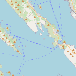
Kali kaardil
Andmeallikad ja metoodika
Meie ilmaprognoosid põhinevad professionaalsel ilmaandmete pakkujal, mis koondab andmeid riiklikelt ilmateenistustelt, satelliidivaatlustelt, radarivõrkudelt ja enam kui 80 000 ilmajaamalt üle maailma. Prognoosiandmeid uuendatakse mitu korda päevas. Me teisendame toorandmed selgeteks kokkuvõteteks – tuulekiirus m/s-des, rõhk mmHg-des – et saaksite oma päeva enesekindlalt planeerida.