5 päeva ilmaprognoos Toronto 25-07-2026
Ilmaprognoos Toronto homme 25.07.2026: päikesepaisteline, temperatuur 19 °C kuni 26 °C.
Sademete tõenäosus 12%. Tuul kuni 4.19 m/s (iilid 5.83 m/s). Õhuniiskus 53–75%, õhurõhk 760–764 mm Hg, UV-indeks kuni 7.3.
5 päeva ühe pilguga — puuduta päeva, et see avada
Päikesetõus 05:59
Päikeseloojang 20:48
Päikeseloojang 20:48
Kasvav kuu90% valgustatud
Kuutõus 18:48 · Kuuloojang 02:08
Kuutõus 18:48 · Kuuloojang 02:08
Graafik
Tabel
| Temperatuur | Vihma tõenäosus | Pilvisus | Niiskus | Rõhk | Tuul | UV-indeks | ||
|---|---|---|---|---|---|---|---|---|
| 00:00 |  Osaliselt pilves | 19 °C | 8% | 26% | 71% | 764 mm Hg | ESE 112° 2 (3.58) m/s | 0 |
| 01:00 | Osaliselt pilves | 19 °C | 9% | 29% | 73% | 764 mm Hg | ESE 102° 1.31 (2.36) m/s | 0 |
| 02:00 | Osaliselt pilves | 19 °C | 11% | 44% | 74% | 764 mm Hg | E 92° 0.89 (1.61) m/s | 0 |
| 03:00 | Osaliselt pilves | 19 °C | 9% | 33% | 73% | 764 mm Hg | ENE 68° 1.39 (2.36) m/s | 0 |
| 04:00 | Osaliselt pilves | 19 °C | 9% | 27% | 73% | 764 mm Hg | E 84° 1.31 (2.19) m/s | 0 |
| 05:00 | Osaliselt pilves | 19 °C | 9% | 28% | 74% | 764 mm Hg | E 94° 1.31 (2.19) m/s | 0 |
| 06:00 |  Selge | 19 °C | 9% | 24% | 74% | 764 mm Hg | E 95° 1.39 (2.25) m/s | 0 |
| 07:00 |  Päikesepaisteline | 19 °C | 9% | 20% | 75% | 764 mm Hg | ESE 104° 1.39 (2.19) m/s | 0.1 |
| 08:00 | Päikesepaisteline | 20 °C | 8% | 20% | 74% | 764 mm Hg | SE 126° 1.5 (2.22) m/s | 0.4 |
| 09:00 | Päikesepaisteline | 21 °C | 7% | 23% | 68% | 764 mm Hg | SSE 167° 1.81 (2.5) m/s | 1.2 |
| 10:00 | Päikesepaisteline | 21 °C | 6% | 23% | 64% | 764 mm Hg | S 181° 2 (2.72) m/s | 1.8 |
| 11:00 | Päikesepaisteline | 22 °C | 5% | 21% | 61% | 763 mm Hg | S 180° 2.11 (2.83) m/s | 3.1 |
| 12:00 | Päikesepaisteline | 24 °C | 3% | 18% | 54% | 763 mm Hg | S 181° 2.61 (3) m/s | 7 |
| 13:00 | Päikesepaisteline | 25 °C | 3% | 18% | 54% | 762 mm Hg | SSE 166° 3.19 (3.94) m/s | 7.3 |
| 14:00 | Päikesepaisteline | 26 °C | 3% | 20% | 53% | 762 mm Hg | SSE 156° 3.61 (4.31) m/s | 6.2 |
| 15:00 | Päikesepaisteline | 26 °C | 4% | 24% | 53% | 761 mm Hg | SE 146° 4.19 (5.06) m/s | 5.3 |
| 16:00 |  Osaliselt pilves | 25 °C | 4% | 28% | 57% | 761 mm Hg | SE 140° 4.19 (5.83) m/s | 4.1 |
| 17:00 |  Kohati kerge vihm võimalik | 25 °C | 12% (0.01 mm/h) | 83% | 60% | 761 mm Hg | SE 141° 3.5 (5.47) m/s | 2.4 |
| 18:00 | Osaliselt pilves | 24 °C | 6% | 31% | 63% | 761 mm Hg | SE 129° 3.19 (5.33) m/s | 1.2 |
| 19:00 | Osaliselt pilves | 23 °C | 6% | 26% | 66% | 761 mm Hg | SE 128° 3.19 (5.25) m/s | 0.5 |
| 20:00 | Päikesepaisteline | 23 °C | 6% | 17% | 67% | 760 mm Hg | SE 139° 3 (5.03) m/s | 0.1 |
| 21:00 | Osaliselt pilves | 22 °C | 8% | 30% | 71% | 760 mm Hg | SSE 160° 2.19 (3.94) m/s | 0 |
| 22:00 | Osaliselt pilves | 22 °C | 10% | 49% | 72% | 760 mm Hg | S 187° 2.19 (4.08) m/s | 0 |
| 23:00 | Selge | 21 °C | 8% | 21% | 74% | 760 mm Hg | SSW 201° 2.81 (5.39) m/s | 0 |
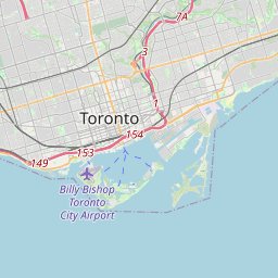
Toronto kaardil
Andmeallikad ja metoodika
Meie ilmaprognoosid põhinevad professionaalsel ilmaandmete pakkujal, mis koondab andmeid riiklikelt ilmateenistustelt, satelliidivaatlustelt, radarivõrkudelt ja enam kui 80 000 ilmajaamalt üle maailma. Prognoosiandmeid uuendatakse mitu korda päevas. Me teisendame toorandmed selgeteks kokkuvõteteks – tuulekiirus m/s-des, rõhk mmHg-des – et saaksite oma päeva enesekindlalt planeerida.