
Pronóstico del tiempo a 5 días San Diego 29 sept 2026

25°21° · Soleado

Pronóstico del tiempo San Diego martes 29 sept 2026: soleado, temperatura de 21 °C a 25 °C.

Probabilidad de precipitaciones 5%. Viento de hasta 5.81 m/s (ráfagas 6.22 m/s). Humedad del aire 42–67%, presión atmosférica 753–756 mm Hg, índice UV de hasta 7.4.

Alertas meteorológicas

Moderate25 sept, 20:48 — 26 sept, 06:00Traducir con Google
Beach Hazards Statement issued September 25 at 8:48PM PDT until September 30 at 4:00PM PDT by NWS San Diego CA

Beach Hazards Statement

* WHAT...Elevated surf of 3-5 feet with sets up to 6 feet through next Tuesday. Astronomical tides of 6.0-6.5 feet through Sunday, rising to 6.5-7.0 feet Monday through Wednesday leading to minor tidal overflow. * WHERE...Beaches of Orange and San Diego Counties. * WHEN...Through Wednesday afternoon. * IMPACTS...Minor tidal overflow and minor coastal erosion expected during high tides. Additionally, elevated surf will lead to strong rip currents. * ADDITIONAL DETAILS...High tides will approach 7.0 feet each morning Monday through Wednesday. These water levels in combination with elevated surf provides a window for moderate coastal flooding on Monday and Tuesday, especially along south and southwest-facing beaches.
Remain out of the water to avoid hazardous swimming conditions.
Moderate26 sept, 05:36 — 26 sept, 14:15Traducir con Google
Beach Hazards Statement issued September 26 at 5:36AM PDT until September 30 at 4:00PM PDT by NWS San Diego CA

Beach Hazards Statement

* WHAT...Elevated surf of 3-5 feet with sets up to 6 feet through next Tuesday. Astronomical tides of 6.0-6.5 feet through Sunday, rising to 6.5-7.0 feet Monday through Wednesday leading to minor tidal overflow. * WHERE...Beaches of Orange and San Diego Counties. * WHEN...Through Wednesday afternoon. * IMPACTS...Minor tidal overflow and minor coastal erosion expected during high tides. Additionally, elevated surf will lead to strong rip currents. * ADDITIONAL DETAILS...High tides will approach 7.0 feet each morning Monday through Wednesday. These water levels in combination with elevated surf provides a window for moderate coastal flooding on Monday and Tuesday, especially along south and southwest-facing beaches.
Remain out of the water to avoid hazardous swimming conditions.
Los 5 días de un vistazo — toca un día para abrirlo
Amanecer 06:41
Atardecer 18:36
Gibosa menguante84% iluminada
Salida de la luna 20:10 · Puesta de la luna 09:43
Gráfico
Tabla

Pronóstico de 21 °C a 25 °C y precipitaciones

Temperatura & Precipitaciones
Hora00:0001:0002:0003:0004:0005:0006:0007:0008:0009:0010:0011:0012:0013:0014:0015:0016:0017:0018:0019:0020:0021:0022:0023:00
Temperatura (°C)212121212121212122232324242425252525252423232322
Precipitaciones (mm/h)000000000000000000000000

Nubosidad y probabilidad de precipitaciones

Nubosidad & Probabilidad de lluvia
Hora00:0001:0002:0003:0004:0005:0006:0007:0008:0009:0010:0011:0012:0013:0014:0015:0016:0017:0018:0019:0020:0021:0022:0023:00
Nubosidad (%)000000000000000000000000
Probabilidad de lluvia (%)444444432111222222224455

Velocidad y dirección del viento

Viento & Ráfaga de viento
Hora00:0001:0002:0003:0004:0005:0006:0007:0008:0009:0010:0011:0012:0013:0014:0015:0016:0017:0018:0019:0020:0021:0022:0023:00
Viento (m/s)1.110.690.690.891.52.312.192.112.192.8944.815.815.1154.694.193.693.192.692.1122.111.69
Ráfaga de viento (m/s)4.115.694.693.891.6433.032.893.033.724.835.426.225.925.755.535.554.223.532.1466.114.69
Dirección del viento (°)OSO 255°OSO 257°ONO 300°ONO 301°NNO 343°N 7°NNE 21°NNE 18°N 2°NNO 342°NO 323°NO 313°NO 308°NO 311°NO 313°NO 308°NO 308°NO 310°NNO 328°NNO 339°ONO 302°O 275°O 261°ONO 284°

Humedad del aire

Humedad
Hora00:0001:0002:0003:0004:0005:0006:0007:0008:0009:0010:0011:0012:0013:0014:0015:0016:0017:0018:0019:0020:0021:0022:0023:00
Humedad (%)646464646464625749424243485051525250515063646767

Presión atmosférica

Presión
Hora00:0001:0002:0003:0004:0005:0006:0007:0008:0009:0010:0011:0012:0013:0014:0015:0016:0017:0018:0019:0020:0021:0022:0023:00
Presión (mm Hg)755755755755755755755755755755755755755755754754753753754754755755756755

Índice ultravioleta

Índice UV
Hora00:0001:0002:0003:0004:0005:0006:0007:0008:0009:0010:0011:0012:0013:0014:0015:0016:0017:0018:0019:0020:0021:0022:0023:00
Índice UV000000000.41.53.45.477.46.64.72.610.200000

Calidad del aire y polen

La calidad del aire solo está disponible para los tres primeros días.

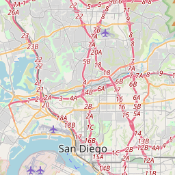
San Diego en el mapa
Fuentes de datos y metodología

Nuestros pronósticos meteorológicos se basan en un proveedor profesional de datos meteorológicos que agrega datos de servicios meteorológicos nacionales, observaciones satelitales, redes de radar y más de 80 000 estaciones meteorológicas en todo el mundo. Los datos de pronóstico se actualizan varias veces al día. Convertimos los datos en bruto en resúmenes claros — velocidad del viento en m/s, presión en mm Hg — para que pueda planificar su día con confianza.