Pronóstico del tiempo a 5 días Salinas 19 nov 2026

14°10° · Chubasco de lluvia ligera

Pronóstico del tiempo Salinas jueves 19 nov 2026: chubasco de lluvia ligera, temperatura de 10 °C a 14 °C.

Probabilidad de precipitaciones 77%. Viento de hasta 8.39 m/s (ráfagas 15.25 m/s). Humedad del aire 69–92%, presión atmosférica 755–763 mm Hg, índice UV de hasta 1.3.

Alertas meteorológicas

Severe17 nov, 11:48 — 18 nov, 05:15Traducir con Google
Flash Flood Watch issued November 17 at 11:48AM PST until November 19 at 4:00AM PST by NWS San Francisco CA

Flash Flood Watch

* WHAT...Flash flooding and debris flows caused by excessive rainfall are possible over the Plaskett and Timber burn areas. * WHERE...For the Timber Scar, portions of CA Highway 1 and the Los Padres National Forecast from Andrew Molera State Park to Partington Ridge including the town of Big Sur. For the Plaskett Scar, areas near CA Highway 1 mile marker 17 to mile marker 11 including Los Burros Road. * WHEN...From early Wednesday morning to early Thursday morning. * IMPACTS...Heavy rainfall over the Timber and Plaskett burn areas is expected during the watch period. Residents near the Timber burn area should prepare for potential debris flow moving through the drainages within Lafler, Castro, and Graves Canyons, as well as drainages between Grimes and Castro Canyons. Residents near the Plaskett burn area should prepare for potential debris flow moving through the Alder, Plaskett, and Prewitt Creeks. Be sure to stay up to date with information from local authorities. Heavy rainfall could trigger flash flooding of low-lying areas, roadway flooding, and debris flows in and near recent wildfire burn scars. * ADDITIONAL DETAILS... - National Weather Service Meteorologists are forecasting heavy rainfall over the Timber and Plaskett burn areas, which may lead to flash flooding and debris flows. - Some locations that may experience flash flooding include... Big Sur, Plaskett, and Pfeiffer Big Sur State Park - http://www.weather.gov/safety/flood
Minor17 nov, 14:29 — 17 nov, 22:30Traducir con Google
Small Craft Advisory issued November 17 at 2:29PM PST until November 18 at 3:00AM PST by NWS San Francisco CA

Small Craft Advisory

* WHAT...For the Small Craft Advisory, south winds 10 to 20 kt with gusts up to 30 kt expected. For the Gale Warning, south winds 20 to 30 kt with gusts up to 45 kt expected. * WHERE...Monterey Bay. * WHEN...For the Small Craft Advisory, from 9 PM this evening to 3 AM PST Wednesday. For the Gale Warning, from 3 AM to 3 PM PST Wednesday. * IMPACTS...Strong winds will cause hazardous seas which could capsize or damage vessels and reduce visibility.
Moderate17 nov, 14:29 — 17 nov, 22:30Traducir con Google
Gale Warning issued November 17 at 2:29PM PST until November 18 at 3:00PM PST by NWS San Francisco CA

Gale Warning

* WHAT...For the Small Craft Advisory, south winds 10 to 20 kt with gusts up to 30 kt expected. For the Gale Warning, south winds 20 to 30 kt with gusts up to 45 kt expected. * WHERE...Monterey Bay. * WHEN...For the Small Craft Advisory, from 9 PM this evening to 3 AM PST Wednesday. For the Gale Warning, from 3 AM to 3 PM PST Wednesday. * IMPACTS...Strong winds will cause hazardous seas which could capsize or damage vessels and reduce visibility.
Los 5 días de un vistazo — toca un día para abrirlo
Amanecer 06:48
Atardecer 16:55
Gibosa creciente81% iluminada
Salida de la luna 13:56 · Puesta de la luna 01:37
Gráfico
Tabla

Pronóstico de 10 °C a 14 °C y precipitaciones

Temperatura & Precipitaciones
Hora00:0001:0002:0003:0004:0005:0006:0007:0008:0009:0010:0011:0012:0013:0014:0015:0016:0017:0018:0019:0020:0021:0022:0023:00
Temperatura (°C)121211111111121212131313131314141413121212111010
Precipitaciones (mm/h)0.430.490.631.051.451.761.641.71.831.511.60.940.430.320.250.310.40.60.470.350.230.180.160.21

Nubosidad y probabilidad de precipitaciones

Nubosidad & Probabilidad de lluvia
Hora00:0001:0002:0003:0004:0005:0006:0007:0008:0009:0010:0011:0012:0013:0014:0015:0016:0017:0018:0019:0020:0021:0022:0023:00
Nubosidad (%)6699981009892537979797969618687888582765354858679
Probabilidad de lluvia (%)475964747777647171686757393933363848443628383839

Velocidad y dirección del viento

Viento & Ráfaga de viento
Hora00:0001:0002:0003:0004:0005:0006:0007:0008:0009:0010:0011:0012:0013:0014:0015:0016:0017:0018:0019:0020:0021:0022:0023:00
Viento (m/s)4.894.314.3144.194.695.896.697.197.818.398.317.6176.1965.695.194.53.812.391.50.610.69
Ráfaga de viento (m/s)9.338.979.259.119.7210.4211.1711.8313.2514.0314.5615.2215.2215.2514.1112.6111.7810.899.678.226.535.754.564.61
Dirección del viento (°)SSO 195°S 184°S 172°SSE 166°SSE 163°SSE 168°SSO 192°SSO 198°SO 217°OSO 248°O 260°O 275°O 281°ONO 284°ONO 288°ONO 289°ONO 293°ONO 290°ONO 292°ONO 291°ONO 284°ONO 287°O 259°SO 230°

Humedad del aire

Humedad
Hora00:0001:0002:0003:0004:0005:0006:0007:0008:0009:0010:0011:0012:0013:0014:0015:0016:0017:0018:0019:0020:0021:0022:0023:00
Humedad (%)888889909291878684838179777672706972757779828788

Presión atmosférica

Presión
Hora00:0001:0002:0003:0004:0005:0006:0007:0008:0009:0010:0011:0012:0013:0014:0015:0016:0017:0018:0019:0020:0021:0022:0023:00
Presión (mm Hg)758758757757756756755755755756756757758758759759760761761761762762763763

Índice ultravioleta

Índice UV
Hora00:0001:0002:0003:0004:0005:0006:0007:0008:0009:0010:0011:0012:0013:0014:0015:0016:0017:0018:0019:0020:0021:0022:0023:00
Índice UV000000000.20.50.30.50.90.71.30.70.30000000

Calidad del aire y polen

Calidad del aire
Hora00:0001:0002:0003:0004:0005:0006:0007:0008:0009:0010:0011:0012:0013:0014:0015:0016:0017:0018:0019:0020:0021:0022:0023:00
PM2.5 (µg/m³)86.45.34.53.92.93.14.66.56.26.35.32.22.12.93.34.34.44.85.97.18.29.29.5
PM10 (µg/m³)12.49.17.56.15.444.57.210.610.210.48.43.23.34.55.26.76.87.49.110.912.313.413.7
Ozono (O₃) (µg/m³)505151515359687579818284858585848278726764636262
NO₂ (µg/m³)8.2654.64.23.73.32.92.31.71.31.31.51.71.61.51.934.66.38.310.411.811.9
SO₂ (µg/m³)0.50.40.40.30.30.30.20.20.20.20.20.30.30.40.40.50.50.50.60.60.70.80.90.9
CO (µg/m³)126120119121123123124123121119117116116116116118123137154165163154145138

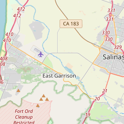
Salinas en el mapa

Fuentes de datos y metodología

Nuestros pronósticos meteorológicos se basan en un proveedor profesional de datos meteorológicos que agrega datos de servicios meteorológicos nacionales, observaciones satelitales, redes de radar y más de 80 000 estaciones meteorológicas en todo el mundo. Los datos de pronóstico se actualizan varias veces al día. Convertimos los datos en bruto en resúmenes claros — velocidad del viento en m/s, presión en mm Hg — para que pueda planificar su día con confianza.