Pronóstico del tiempo a 5 días Niagara Falls 15-08-2026

Pronóstico del tiempo Niagara Falls sábado, 15 de agosto 15.08.2026: soleado, temperatura de 15 °C a 25 °C.

Probabilidad de precipitaciones 37%. Viento de hasta 3.5 m/s (ráfagas 5.75 m/s). Humedad del aire 43–88%, presión atmosférica 765–769 mm Hg, índice UV de hasta 7.

Alertas meteorológicas

Ocultar alertas
Moderate12 ago, 12:0313 ago, 01:02Traducir con Google
yellow watch - severe thunderstorm - in effect

thunderstorm

Conditions are favourable for the development of severe thunderstorms that may be capable of producing strong wind gusts, large hail and heavy rain. What: Wind gusts near 100 km/h. Toonie sized hail. Heavy rain in excess of 40 mm. When: This afternoon into this evening. Additional Information: The highest rainfall amounts are expected for areas that receive multiple thunderstorms. ### Local utility outages are possible. Fast-moving and rapidly rising water can sweep vehicles away and damage infrastructure. Severe thunderstorm watches are issued when conditions are favourable for the development of thunderstorms capable of producing damaging hail, wind or rain. Please continue to monitor alerts and forecasts issued by Environment Canada. To report severe weather, send an email to ONstorm@ec.gc.ca or post reports on social media using #ONStorm. For more information: https://www.ontario.ca/page/be-prepared-emergency.
When thunder roars, go indoors! Lightning kills and injures Canadians every year. Secure loose objects. Emergency Management Ontario recommends that you take cover immediately if threatening weather approaches.
Severe12 ago, 12:0813 ago, 02:00Traducir con Google
squall watch in effect

squall

Conditions are favourable for the development of squalls with wind gusts up to 45 knots, frequent lightning and hail. Thunderstorms are expected to track east over the lakes this afternoon and evening. ### Please continue to monitor alerts and forecasts issued by Environment Canada. For more information monitor Canadian Coast Guard radio or Weatheradio stations.
Mariners are advised to prepare for potential squalls. Vulnerable vessels are most at risk and should seek safe harbour if underway.
Los 5 días de un vistazo — toca un día para abrirlo
Amanecer 06:22
Atardecer 20:19
Luna creciente11% iluminada
Salida de la luna 09:40 · Puesta de la luna 21:35
Gráfico
Tabla

Pronóstico de 15 °C a 25 °C y precipitaciones

Temperatura & Precipitaciones
Hora00:0001:0002:0003:0004:0005:0006:0007:0008:0009:0010:0011:0012:0013:0014:0015:0016:0017:0018:0019:0020:0021:0022:0023:00
Temperatura (°C)181717161616151617192122242424252423222121212019
Precipitaciones (mm/h)000000000000000000000.020.070.060.45

Nubosidad y probabilidad de precipitaciones

Nubosidad & Probabilidad de lluvia
Hora00:0001:0002:0003:0004:0005:0006:0007:0008:0009:0010:0011:0012:0013:0014:0015:0016:0017:0018:0019:0020:0021:0022:0023:00
Nubosidad (%)46432116121062021261730145147504778726563
Probabilidad de lluvia (%)111213131413131185433232467712171737

Velocidad y dirección del viento

Viento & Ráfaga de viento
Hora00:0001:0002:0003:0004:0005:0006:0007:0008:0009:0010:0011:0012:0013:0014:0015:0016:0017:0018:0019:0020:0021:0022:0023:00
Viento (m/s)3.192.392.312.312.612.312.52.312.53.112.812.52.52.612.612.391.311.692.1921.190.811.693.5
Ráfaga de viento (m/s)5.754.424.254.254.834.394.864.313.973.973.312.892.89332.751.612.393.393.422.171.332.675.28
Dirección del viento (°)E 96°ESE 104°ESE 102°E 101°E 100°ESE 107°ESE 108°ESE 112°ESE 106°ESE 107°ESE 106°E 94°ENE 73°ENE 65°ENE 71°ENE 67°NE 43°NE 38°NE 47°NNE 28°NNE 19°O 279°SO 218°SSO 206°

Humedad del aire

Humedad
Hora00:0001:0002:0003:0004:0005:0006:0007:0008:0009:0010:0011:0012:0013:0014:0015:0016:0017:0018:0019:0020:0021:0022:0023:00
Humedad (%)858788888888878477665850464544434654586161606270

Presión atmosférica

Presión
Hora00:0001:0002:0003:0004:0005:0006:0007:0008:0009:0010:0011:0012:0013:0014:0015:0016:0017:0018:0019:0020:0021:0022:0023:00
Presión (mm Hg)767768768768768768768769769769769769768768767767767766765765765766765765

Índice ultravioleta

Índice UV
Hora00:0001:0002:0003:0004:0005:0006:0007:0008:0009:0010:0011:0012:0013:0014:0015:0016:0017:0018:0019:0020:0021:0022:0023:00
Índice UV00000000.10.61.73.45.4774.12.11.21.10.10.10000

Calidad del aire y polen

Calidad del aire
Hora00:0001:0002:0003:0004:0005:0006:0007:0008:0009:0010:0011:0012:0013:0014:0015:0016:0017:0018:0019:0020:0021:0022:0023:00
PM2.5 (µg/m³)4.54.54.44.34.24.44.54.74.33.62.82.42.32.22.32.42.733.63.83.63.12.82.9
PM10 (µg/m³)4.54.54.54.34.34.44.64.84.43.62.92.52.42.32.42.52.83.13.73.93.73.22.92.9
Ozono (O₃) (µg/m³)6562605856555351525868768184879298100958779736762
NO₂ (µg/m³)887.97.77.57.37.47.575.43.21.61.11.11.31.31.52.246.487.97.16.5
SO₂ (µg/m³)0.90.70.60.60.60.70.80.90.90.90.80.70.70.70.70.811.11.21.31.31.10.80.6
CO (µg/m³)241242235210176153151158162154142133129128127125124124128134138140140141

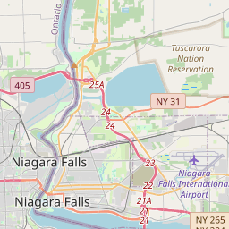
Niagara Falls en el mapa

Fuentes de datos y metodología

Nuestros pronósticos meteorológicos se basan en un proveedor profesional de datos meteorológicos que agrega datos de servicios meteorológicos nacionales, observaciones satelitales, redes de radar y más de 80 000 estaciones meteorológicas en todo el mundo. Los datos de pronóstico se actualizan varias veces al día. Convertimos los datos en bruto en resúmenes claros — velocidad del viento en m/s, presión en mm Hg — para que pueda planificar su día con confianza.