Pronóstico del tiempo a 5 días Toronto 25-07-2026
Pronóstico del tiempo Toronto mañana 25.07.2026: soleado, temperatura de 19 °C a 26 °C.
Probabilidad de precipitaciones 12%. Viento de hasta 4.19 m/s (ráfagas 5.83 m/s). Humedad del aire 53–75%, presión atmosférica 760–764 mm Hg, índice UV de hasta 7.3.
Los 5 días de un vistazo — toca un día para abrirlo
Amanecer 05:59
Atardecer 20:48
Atardecer 20:48
Gibosa creciente90% iluminada
Salida de la luna 18:48 · Puesta de la luna 02:08
Salida de la luna 18:48 · Puesta de la luna 02:08
Gráfico
Tabla
| Temperatura | Probabilidad de lluvia | Nubosidad | Humedad | Presión | Viento | Índice UV | ||
|---|---|---|---|---|---|---|---|---|
| 00:00 |  Parcialmente nublado | 19 °C | 8% | 26% | 71% | 764 mm Hg | ESE 112° 2 (3.58) m/s | 0 |
| 01:00 | Parcialmente nublado | 19 °C | 9% | 29% | 73% | 764 mm Hg | ESE 102° 1.31 (2.36) m/s | 0 |
| 02:00 | Parcialmente nublado | 19 °C | 11% | 44% | 74% | 764 mm Hg | E 92° 0.89 (1.61) m/s | 0 |
| 03:00 | Parcialmente nublado | 19 °C | 9% | 33% | 73% | 764 mm Hg | ENE 68° 1.39 (2.36) m/s | 0 |
| 04:00 | Parcialmente nublado | 19 °C | 9% | 27% | 73% | 764 mm Hg | E 84° 1.31 (2.19) m/s | 0 |
| 05:00 | Parcialmente nublado | 19 °C | 9% | 28% | 74% | 764 mm Hg | E 94° 1.31 (2.19) m/s | 0 |
| 06:00 |  Despejado | 19 °C | 9% | 24% | 74% | 764 mm Hg | E 95° 1.39 (2.25) m/s | 0 |
| 07:00 |  Soleado | 19 °C | 9% | 20% | 75% | 764 mm Hg | ESE 104° 1.39 (2.19) m/s | 0.1 |
| 08:00 | Soleado | 20 °C | 8% | 20% | 74% | 764 mm Hg | SE 126° 1.5 (2.22) m/s | 0.4 |
| 09:00 | Soleado | 21 °C | 7% | 23% | 68% | 764 mm Hg | SSE 167° 1.81 (2.5) m/s | 1.2 |
| 10:00 | Soleado | 21 °C | 6% | 23% | 64% | 764 mm Hg | S 181° 2 (2.72) m/s | 1.8 |
| 11:00 | Soleado | 22 °C | 5% | 21% | 61% | 763 mm Hg | S 180° 2.11 (2.83) m/s | 3.1 |
| 12:00 | Soleado | 24 °C | 3% | 18% | 54% | 763 mm Hg | S 181° 2.61 (3) m/s | 7 |
| 13:00 | Soleado | 25 °C | 3% | 18% | 54% | 762 mm Hg | SSE 166° 3.19 (3.94) m/s | 7.3 |
| 14:00 | Soleado | 26 °C | 3% | 20% | 53% | 762 mm Hg | SSE 156° 3.61 (4.31) m/s | 6.2 |
| 15:00 | Soleado | 26 °C | 4% | 24% | 53% | 761 mm Hg | SE 146° 4.19 (5.06) m/s | 5.3 |
| 16:00 |  Parcialmente nublado | 25 °C | 4% | 28% | 57% | 761 mm Hg | SE 140° 4.19 (5.83) m/s | 4.1 |
| 17:00 |  Posible lluvia dispersa | 25 °C | 12% (0.01 mm/h) | 83% | 60% | 761 mm Hg | SE 141° 3.5 (5.47) m/s | 2.4 |
| 18:00 | Parcialmente nublado | 24 °C | 6% | 31% | 63% | 761 mm Hg | SE 129° 3.19 (5.33) m/s | 1.2 |
| 19:00 | Parcialmente nublado | 23 °C | 6% | 26% | 66% | 761 mm Hg | SE 128° 3.19 (5.25) m/s | 0.5 |
| 20:00 | Soleado | 23 °C | 6% | 17% | 67% | 760 mm Hg | SE 139° 3 (5.03) m/s | 0.1 |
| 21:00 | Parcialmente nublado | 22 °C | 8% | 30% | 71% | 760 mm Hg | SSE 160° 2.19 (3.94) m/s | 0 |
| 22:00 | Parcialmente nublado | 22 °C | 10% | 49% | 72% | 760 mm Hg | S 187° 2.19 (4.08) m/s | 0 |
| 23:00 | Despejado | 21 °C | 8% | 21% | 74% | 760 mm Hg | SSO 201° 2.81 (5.39) m/s | 0 |
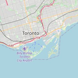
Toronto en el mapa
Fuentes de datos y metodología
Nuestros pronósticos meteorológicos se basan en un proveedor profesional de datos meteorológicos que agrega datos de servicios meteorológicos nacionales, observaciones satelitales, redes de radar y más de 80 000 estaciones meteorológicas en todo el mundo. Los datos de pronóstico se actualizan varias veces al día. Convertimos los datos en bruto en resúmenes claros — velocidad del viento en m/s, presión en mm Hg — para que pueda planificar su día con confianza.