5-day weather forecast Sydney 01-08-2026

Weather forecast Sydney tomorrow 01.08.2026: patchy rain possible, temperature from 10 °C to 15 °C.

Precipitation probability 38%. Wind up to 4 m/s (gusts 6.39 m/s). Air humidity 67–79%, atmospheric pressure 773–776 mm Hg, UV index up to 1.6.

5 days at a glance — tap a day to open it
Sunrise 06:47
Sunset 17:15
Waning Gibbous83% illuminated
Moonrise 19:55 · Moonset 08:12
Chart
Table

Forecast from 10 °C to 15 °C and precipitation

Temperature & Precipitation
Time00:0001:0002:0003:0004:0005:0006:0007:0008:0009:0010:0011:0012:0013:0014:0015:0016:0017:0018:0019:0020:0021:0022:0023:00
Temperature (°C)111111111010101011121313131314141514131313131312
Precipitation (mm/hr)00.010.030.020.080.070.180.230.290.240.290.280.180.090.09000000000

Cloud cover and precipitation probability

Cloud cover & Rain chance
Time00:0001:0002:0003:0004:0005:0006:0007:0008:0009:0010:0011:0012:0013:0014:0015:0016:0017:0018:0019:0020:0021:0022:0023:00
Cloud cover (%)6054738683846480891001001001006179372847178692049
Rain chance (%)14141820262628353836383733192287108877913

Wind speed and direction

Wind & Wind gust
Time00:0001:0002:0003:0004:0005:0006:0007:0008:0009:0010:0011:0012:0013:0014:0015:0016:0017:0018:0019:0020:0021:0022:0023:00
Wind (m/s)3.313.8943.393.112.893.1132.812.692.191.891.891.691.110.50.691.1122.813.193.112.892.5
Wind gust (m/s)5.476.396.225.395.284.925.084.894.063.472.892.472.532.251.420.640.921.723.424.895.585.425.064.33
Wind direction (°)WSW 246°WSW 253°WSW 244°WSW 239°SW 234°SW 234°SW 232°SW 226°SW 223°SW 228°SW 232°SW 236°WSW 245°WSW 245°SW 228°SSE 164°E 86°ENE 66°NE 49°NE 44°NE 39°NNE 27°NNE 15°N 351°

Air humidity

Humidity
Time00:0001:0002:0003:0004:0005:0006:0007:0008:0009:0010:0011:0012:0013:0014:0015:0016:0017:0018:0019:0020:0021:0022:0023:00
Humidity (%)757776767778787976737172737371686771747574737477

Atmospheric pressure

Pressure
Time00:0001:0002:0003:0004:0005:0006:0007:0008:0009:0010:0011:0012:0013:0014:0015:0016:0017:0018:0019:0020:0021:0022:0023:00
Pressure (mm Hg)775774774774774774775775776776776776775774774774773774774775775775775775

Ultraviolet index

UV Index
Time00:0001:0002:0003:0004:0005:0006:0007:0008:0009:0010:0011:0012:0013:0014:0015:0016:0017:0018:0019:0020:0021:0022:0023:00
UV Index000000000.30.91.21.51.61.61.40.80.20000000

Air quality & pollen

Air quality
Time00:0001:0002:0003:0004:0005:0006:0007:0008:0009:0010:0011:0012:0013:0014:0015:0016:0017:0018:0019:0020:0021:0022:0023:00
PM2.5 (µg/m³)1110.5109.68.78.48.711.514.514.91210.29.89.710.110.410.811.414.81616.516.815.416.9
PM10 (µg/m³)13.112.411.911.610.510.110.513.216.116.614.714.114.314.515.416.116.917.821.222.522.923.119.921
Ozone (O₃) (µg/m³)303031313128242327333945525658585649393127242116
NO₂ (µg/m³)25.524.322.821.220.522.124.82624.621.818.715.111.18.26.66.17.612.419.224.92829.931.934.6
SO₂ (µg/m³)5.55.35.1555.35.86.47.48.68.97.85.84.33.63.23.23.64.24.95.45.96.47
CO (µg/m³)117120112999298109122138154157133966960627293123150172191204210

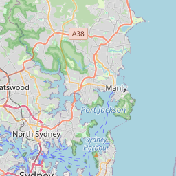
Sydney on the map

Data Sources & Methodology

Our weather forecasts are powered by a professional weather data provider that aggregates data from national weather services, satellite observations, radar networks, and over 80,000 weather stations worldwide. Forecast data is updated multiple times daily. We convert raw data into clear summaries — wind speed in m/s, pressure in mmHg — so you can plan your day with confidence.