5-day weather forecast Sydney 20-08-2026

Weather forecast Sydney Thursday, August 20 20.08.2026: overcast, temperature from 14 °C to 19 °C.

Precipitation probability 23%. Wind up to 7.11 m/s (gusts 11.11 m/s). Air humidity 55–77%, atmospheric pressure 767–771 mm Hg, UV index up to 4.2.

Sunrise 06:28
Sunset 17:28
First Quarter58% illuminated
Moonrise 10:31 · Moonset 00:32
Chart
Table

Forecast from 14 °C to 19 °C and precipitation

Temperature & Precipitation
Time00:0001:0002:0003:0004:0005:0006:0007:0008:0009:0010:0011:0012:0013:0014:0015:0016:0017:0018:0019:0020:0021:0022:0023:00
Temperature (°C)151515141414141415151718191918181819191818181817
Precipitation (mm/hr)000000000000000.010.0100.010.070.050000

Cloud cover and precipitation probability

Cloud cover & Rain chance
Time00:0001:0002:0003:0004:0005:0006:0007:0008:0009:0010:0011:0012:0013:0014:0015:0016:0017:0018:0019:0020:0021:0022:0023:00
Cloud cover (%)555573100869810060510010010010010010010010096100100100100
Rain chance (%)888816201618179313141517171718232017161616

Wind speed and direction

Wind & Wind gust
Time00:0001:0002:0003:0004:0005:0006:0007:0008:0009:0010:0011:0012:0013:0014:0015:0016:0017:0018:0019:0020:0021:0022:0023:00
Wind (m/s)3.393.393.53.613.113.613.813.693.393.193.313.312.894.817.115.695.192.892.392.891.692.3933.5
Wind gust (m/s)54.314.424.223.614.424.8954.924.694.694.53.398.8111.116.316.113.222.53.55.692.53.724.83
Wind direction (°)NNW 340°NNW 348°NNW 339°NW 316°NW 312°NNW 329°NNW 334°NW 326°NNW 328°NNW 332°NNW 346°N 8°NNE 30°NE 53°NE 40°NE 42°NNE 28°N 9°NNW 336°WNW 297°NW 312°NW 323°NW 307°NW 308°

Air humidity

Humidity
Time00:0001:0002:0003:0004:0005:0006:0007:0008:0009:0010:0011:0012:0013:0014:0015:0016:0017:0018:0019:0020:0021:0022:0023:00
Humidity (%)777676767573716966635655586167666768696666646464

Atmospheric pressure

Pressure
Time00:0001:0002:0003:0004:0005:0006:0007:0008:0009:0010:0011:0012:0013:0014:0015:0016:0017:0018:0019:0020:0021:0022:0023:00
Pressure (mm Hg)771771771770770770770771771771770770769768767768768768769769769769769769

Ultraviolet index

UV Index
Time00:0001:0002:0003:0004:0005:0006:0007:0008:0009:0010:0011:0012:0013:0014:0015:0016:0017:0018:0019:0020:0021:0022:0023:00
UV Index00000000.10.51.51.63.74.23.31.80.60.30000000

Air quality & pollen

Air quality
Time00:0001:0002:0003:0004:0005:0006:0007:0008:0009:0010:0011:0012:0013:0014:0015:0016:0017:0018:0019:0020:0021:0022:0023:00
PM2.5 (µg/m³)7.17.78.28.58.6910.113.316.116.416.414.712.511.111.512.111.512.719.820.617.616.516.917.7
PM10 (µg/m³)88.599.29.39.710.71416.917.918.316.614.613.614.415.314.414.921.922.21917.717.718.2
Ozone (O₃) (µg/m³)292421181612991525375167798791876841201313129
NO₂ (µg/m³)23.424.825.526.126.928.630.531.230.127.724.620.114.8118.26.910.824.643.656.858.855.251.549.8
SO₂ (µg/m³)7.97.87.67.57.78.18.7101316.718.516.7139.986.76.26.98.49.61010.19.99.4
CO (µg/m³)144157145122112127155178190198194181153.8121112109117148192220218200187186

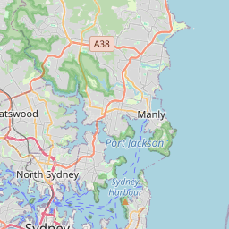
Sydney on the map

Data Sources & Methodology

Our weather forecasts are powered by a professional weather data provider that aggregates data from national weather services, satellite observations, radar networks, and over 80,000 weather stations worldwide. Forecast data is updated multiple times daily. We convert raw data into clear summaries — wind speed in m/s, pressure in mmHg — so you can plan your day with confidence.