5-day weather forecast Los Angeles 07-08-2026

Weather forecast Los Angeles today 07.08.2026: sunny, temperature from 18 °C to 36 °C.

Precipitation probability 23%. Wind up to 4.69 m/s (gusts 5.42 m/s). Air humidity 38–95%, atmospheric pressure 760–762 mm Hg, UV index up to 10.3.

Weather Alerts

Hide alerts
SevereAug 7, 09:11 AMAug 9, 08:00 PMTranslate with Google
Extreme Heat Warning issued August 7 at 9:11AM PDT until August 9 at 8:00PM PDT by NWS Los Angeles/Oxnard CA

Extreme Heat Warning

* WHAT...Dangerously hot daytime conditions with high temperatures between 95 and 105 common, except locally up to 108 in the hottest locations. * WHERE...Northern Ventura County Mountains. * WHEN...Until 8 PM PDT Sunday. * IMPACTS...There is a high risk for dangerous heat illness, especially for sensitive groups like the very young, the very old, those without air conditioning, and those active outdoors.
Drink plenty of fluids, stay in an air-conditioned room, stay out of the sun, and check up on relatives and neighbors. Do not leave young children and pets in unattended vehicles. Car interiors will reach lethal temperatures in a matter of minutes. Take extra precautions when outside. Wear lightweight and loose fitting clothing. Try to limit strenuous activities to early morning or evening. Take action when you see symptoms of heat exhaustion and heat stroke. To reduce risk during outdoor work, the Occupational Safety and Health Administration recommends scheduling frequent rest breaks in shaded or air conditioned environments. Anyone overcome by heat should be moved to a cool and shaded location. Heat stroke is an emergency! Call 9 1 1. Stay cool, stay hydrated, stay informed. Monitor the latest forecasts and warnings for updates. If you do not have air conditioning in your home or lack shelter, you can call 2 1 1 for assistance locating appropriate shelter from the heat.
SevereAug 7, 12:00 AMAug 7, 04:00 PMTranslate with Google
Extreme Heat Warning issued August 7 at 12:00AM MST until August 9 at 8:00PM MST by NWS Phoenix AZ

Extreme Heat Warning

* WHAT...Dangerously hot and humid conditions. Afternoon temperatures 98 to 114 degrees. Major Heat Risk. * WHERE...Chuckwalla Mountains, Chiriaco Summit, and Joshua Tree National Park. * WHEN...Until 8 PM PDT Sunday. * IMPACTS...Heat related illnesses increase significantly during extreme heat events. Overexposure can cause heat cramps and heat exhaustion to develop and, without intervention, can lead to heat stroke.
An Extreme Heat Warning means that a period of very hot temperatures, even by local standards, will occur. Actions should be taken to lessen the impact of the extreme heat. Take extra precautions if you work or spend time outside. When possible, reschedule strenuous activities to early morning or evening. Know the signs and symptoms of heat exhaustion and heat stroke. Wear lightweight and loose-fitting clothing when possible and drink plenty of water. To reduce risk during outdoor work, the Occupational Safety and Health Administration recommends scheduling frequent rest breaks in shaded or air conditioned environments. Anyone overcome by heat should be moved to a cool and shaded location. Heat stroke is an emergency! Call 9 1 1. Public cooling shelters are available in some areas. Consult county officials for more details.
ModerateAug 7, 04:10 AMAug 7, 03:30 PMTranslate with Google
Heat Advisory issued August 7 at 4:10AM PDT until August 9 at 8:00PM PDT by NWS San Diego CA

Heat Advisory

* WHAT...High temperatures mostly in the mid 80s to upper 90s below 6500 feet expected. * WHERE...San Bernardino County Mountains. * WHEN...Until 8 PM PDT Sunday. * IMPACTS...Hot temperatures may cause heat illnesses.
Drink plenty of fluids, stay in an air-conditioned room, stay out of the sun, and check up on relatives and neighbors.
SevereAug 7, 04:10 AMAug 7, 03:30 PMTranslate with Google
Extreme Heat Warning issued August 7 at 4:10AM PDT until August 9 at 8:00PM PDT by NWS San Diego CA

Extreme Heat Warning

* WHAT...Dangerously hot conditions with temperatures of 100 to 110 expected. * WHERE...Apple and Lucerne Valleys. * WHEN...Until 8 PM PDT Sunday. * IMPACTS...Heat related illnesses increase significantly during extreme heat events.
Drink plenty of fluids, stay in an air-conditioned room, stay out of the sun, and check up on relatives and neighbors.
Sunrise 06:08
Sunset 19:48
Waning Crescent24% illuminated
Moonrise 00:12 · Moonset 15:16
Chart
Table
Fri, Aug 7, 2026

Forecast from 18 °C to 36 °C and precipitation

Temperature & Precipitation
Time00:0001:0002:0003:0004:0005:0006:0007:0008:0009:0010:0011:0012:0013:0014:0015:0016:0017:0018:0019:0020:0021:0022:0023:00
Temperature (°C)202019191918182021232631343635353431292722212121
Precipitation (mm/hr)000000000000000000000000

Cloud cover and precipitation probability

Cloud cover & Rain chance
Time00:0001:0002:0003:0004:0005:0006:0007:0008:0009:0010:0011:0012:0013:0014:0015:0016:0017:0018:0019:0020:0021:0022:0023:00
Cloud cover (%)27141111410605159311661012114610283855
Rain chance (%)1716161614162321201163111111359141620

Wind speed and direction

Wind & Wind gust
Time00:0001:0002:0003:0004:0005:0006:0007:0008:0009:0010:0011:0012:0013:0014:0015:0016:0017:0018:0019:0020:0021:0022:0023:00
Wind (m/s)1.390.891.391.111.391.311.110.811.392.312.192.392.8133.814.394.694.694.313.612.891.891.811.81
Wind gust (m/s)1.831.191.891.531.971.831.561.081.612.642.532.753.223.444.365.065.425.424.944.143.532.422.362.42
Wind direction (°)SSW 194°S 178°S 180°SW 224°SW 236°SW 219°SSW 199°WSW 239°SW 221°SSW 200°SSW 210°SSW 213°SW 221°SW 231°SW 228°SW 233°WSW 238°WSW 238°WSW 237°SW 232°SW 232°SW 223°SW 215°SW 215°

Air humidity

Humidity
Time00:0001:0002:0003:0004:0005:0006:0007:0008:0009:0010:0011:0012:0013:0014:0015:0016:0017:0018:0019:0020:0021:0022:0023:00
Humidity (%)939495949294959589786857423844444145556677868890

Atmospheric pressure

Pressure
Time00:0001:0002:0003:0004:0005:0006:0007:0008:0009:0010:0011:0012:0013:0014:0015:0016:0017:0018:0019:0020:0021:0022:0023:00
Pressure (mm Hg)761761761761761761761761761762762762761761761761761760760760761761761761

Ultraviolet index

UV Index
Time00:0001:0002:0003:0004:0005:0006:0007:0008:0009:0010:0011:0012:0013:0014:0015:0016:0017:0018:0019:0020:0021:0022:0023:00
UV Index00000000.21.12.85.17.69.710.39.47.34.72.30.80.20000

Air quality & pollen

Air quality
Time00:0001:0002:0003:0004:0005:0006:0007:0008:0009:0010:0011:0012:0013:0014:0015:0016:0017:0018:0019:0020:0021:0022:0023:00
PM2.5 (µg/m³)18.52225.328.431.233.83637.731.225.425.42524.624.223.722.821.62018.116.615.214.414.315.1
PM10 (µg/m³)20.423.927.230.333.235.73839.733.528.628.828.628.42827.32624.322.220.218.917.416.516.517.2
Ozone (O₃) (µg/m³)3523137349183046658410312113514214414113011296837058
NO₂ (µg/m³)4555.263.268.371.270.966.258.349.841.131.823.918.21410.78.26.66.47.910.814.418.42328.3
SO₂ (µg/m³)3.43.53.63.63.63.73.844.55.77.38.48.78.58.17.56.75.84.83.832.72.62.6
CO (µg/m³)207218231248266279287290284264236212196185174163153148149153159165172179
Fri, Aug 7, 2026

Frequently asked questions about the 5-day weather in Los Angeles

Over the next 5 days in Los Angeles the temperature is expected to range from about 18 to 36 °C. See the detailed hourly forecast for each of the 5 days in the charts above.

The chance of rain in Los Angeles over the next 5 days reaches 25%. Check the 5-day precipitation chart above to see exactly which days and hours bring rain.

A 5-day forecast is fairly reliable: the first 2–3 days are usually very accurate, while days 4–5 may be refined. The data is updated several times a day, so check back before important plans.

Over the next 5 days the temperature in Los Angeles ranges from about 18 to 36 °C. Compare the warmest and coolest day on the temperature chart above.

Over the next 5 days the wind in Los Angeles picks up to 5 m/s. The windiest days are easy to spot on the wind chart above.

For a walk or a trip, pick the days with the lowest chance of rain (up to 25%) and light wind — easy to compare on the 5-day charts above.

The first 2–3 days are reliable enough for firm decisions, while days 4–5 are a guide that sharpens as they approach. The forecast is updated several times a day, so check again before important plans.

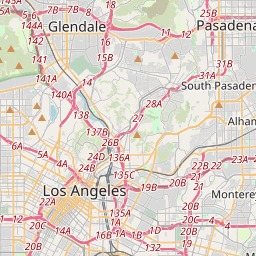
Los Angeles on the map

Data Sources & Methodology

Our weather forecasts are powered by a professional weather data provider that aggregates data from national weather services, satellite observations, radar networks, and over 80,000 weather stations worldwide. Forecast data is updated multiple times daily. We convert raw data into clear summaries — wind speed in m/s, pressure in mmHg — so you can plan your day with confidence.