
5-day weather forecast Korhogo Nov 18, 2026

34°23° · Cloudy

Weather forecast Korhogo Wednesday Nov 18, 2026: cloudy, temperature from 23 °C to 34 °C.

Precipitation probability 15%. Wind up to 1.81 m/s (gusts 8.64 m/s). Air humidity 31–83%, atmospheric pressure 756–760 mm Hg, UV index up to 8.7.

Sunrise 06:17
Sunset 17:57
Waxing Gibbous73% illuminated
Moonrise 13:28 · Moonset 00:57
Chart
Table

Forecast from 23 °C to 34 °C and precipitation

Temperature & Precipitation
Time00:0001:0002:0003:0004:0005:0006:0007:0008:0009:0010:0011:0012:0013:0014:0015:0016:0017:0018:0019:0020:0021:0022:0023:00
Temperature (°C)262625252424232426283032333434343332302929282727
Precipitation (mm/hr)000000000000000000000000

Cloud cover and precipitation probability

Cloud cover & Rain chance
Time00:0001:0002:0003:0004:0005:0006:0007:0008:0009:0010:0011:0012:0013:0014:0015:0016:0017:0018:0019:0020:0021:0022:0023:00
Cloud cover (%)865971705751295068909283978785656964537480868992
Rain chance (%)1410131413141314141512998755547891112

Wind speed and direction

Wind & Wind gust
Time00:0001:0002:0003:0004:0005:0006:0007:0008:0009:0010:0011:0012:0013:0014:0015:0016:0017:0018:0019:0020:0021:0022:0023:00
Wind (m/s)1.1910.811.111.311.51.611.191.51.611.110.610.390.891.391.811.390.890.690.50.691.391.310.89
Wind gust (m/s)2.812.331.972.833.423.673.033.083.533.813.282.923.193.754.114.543.142.782.252.535.788.647.92
Wind direction (°)S 186°SSW 201°SW 227°SW 232°SW 236°WSW 239°SW 231°SW 222°SW 222°SW 221°SW 218°SSW 209°ESE 112°ENE 76°ENE 70°ENE 67°NE 55°NE 34°NNE 26°E 94°ESE 117°SE 138°SSE 168°S 183°

Air humidity

Humidity
Time00:0001:0002:0003:0004:0005:0006:0007:0008:0009:0010:0011:0012:0013:0014:0015:0016:0017:0018:0019:0020:0021:0022:0023:00
Humidity (%)666971737679838073675749403633313439434547495357

Atmospheric pressure

Pressure
Time00:0001:0002:0003:0004:0005:0006:0007:0008:0009:0010:0011:0012:0013:0014:0015:0016:0017:0018:0019:0020:0021:0022:0023:00
Pressure (mm Hg)758758758758758758758759760760760759758758757756756757757758758759759759

Ultraviolet index

UV Index
Time00:0001:0002:0003:0004:0005:0006:0007:0008:0009:0010:0011:0012:0013:0014:0015:0016:0017:0018:0019:0020:0021:0022:0023:00
UV Index00000000.10.82.657.48.78.474.51.90.5000000

Air quality & pollen

Air quality is available for the first three days only.

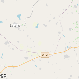
Korhogo on the map
Data Sources & Methodology

Our weather forecasts are powered by a professional weather data provider that aggregates data from national weather services, satellite observations, radar networks, and over 80,000 weather stations worldwide. Forecast data is updated multiple times daily. We convert raw data into clear summaries — wind speed in m/s, pressure in mmHg — so you can plan your day with confidence.