5-day weather forecast Korhogo Nov 17, 2026

34°23° · Partly cloudy

Weather forecast Korhogo Tuesday Nov 17, 2026: partly cloudy, temperature from 23 °C to 34 °C.

Precipitation probability 13%. Wind up to 2.5 m/s (gusts 5.53 m/s). Air humidity 38–88%, atmospheric pressure 756–761 mm Hg, UV index up to 9.2.

Sunrise 06:17
Sunset 17:57
First Quarter63% illuminated
Moonrise 12:52 · Moonset 00:13
Chart
Table

Forecast from 23 °C to 34 °C and precipitation

Temperature & Precipitation
Time00:0001:0002:0003:0004:0005:0006:0007:0008:0009:0010:0011:0012:0013:0014:0015:0016:0017:0018:0019:0020:0021:0022:0023:00
Temperature (°C)262625252423232425272931333334333332302929282827
Precipitation (mm/hr)000000000000000000000000

Cloud cover and precipitation probability

Cloud cover & Rain chance
Time00:0001:0002:0003:0004:0005:0006:0007:0008:0009:0010:0011:0012:0013:0014:0015:0016:0017:0018:0019:0020:0021:0022:0023:00
Cloud cover (%)42495049331712341226425256654848547386939384
Rain chance (%)101112131313121186444445446911131312

Wind speed and direction

Wind & Wind gust
Time00:0001:0002:0003:0004:0005:0006:0007:0008:0009:0010:0011:0012:0013:0014:0015:0016:0017:0018:0019:0020:0021:0022:0023:00
Wind (m/s)1.6122.392.52.1121.8922.392.391.690.890.310.891.521.310.810.890.890.810.610.891.19
Wind gust (m/s)2.533.534.755.114.314.224.895.535.254.924.53.944.254.674.674.7543.563.0333.393.062.893.28
Wind direction (°)SSW 193°SSW 203°SSW 208°SSW 207°SSW 203°SSW 210°SSW 213°SW 216°SW 215°SW 214°SW 216°SSW 202°ESE 122°ENE 73°ENE 63°ENE 67°E 81°ESE 122°S 171°SSE 158°SSE 153°S 190°SSW 201°S 186°

Air humidity

Humidity
Time00:0001:0002:0003:0004:0005:0006:0007:0008:0009:0010:0011:0012:0013:0014:0015:0016:0017:0018:0019:0020:0021:0022:0023:00
Humidity (%)727476798386888578706254464340384248535658606163

Atmospheric pressure

Pressure
Time00:0001:0002:0003:0004:0005:0006:0007:0008:0009:0010:0011:0012:0013:0014:0015:0016:0017:0018:0019:0020:0021:0022:0023:00
Pressure (mm Hg)760759759759759759760760760761760759758758757756757757757758758759759759

Ultraviolet index

UV Index
Time00:0001:0002:0003:0004:0005:0006:0007:0008:0009:0010:0011:0012:0013:0014:0015:0016:0017:0018:0019:0020:0021:0022:0023:00
UV Index00000000.10.92.75.27.79.28.974.41.80.5000000

Air quality & pollen

Air quality
Time00:0001:0002:0003:0004:0005:0006:0007:0008:0009:0010:0011:0012:0013:0014:0015:0016:0017:0018:0019:0020:0021:0022:0023:00
PM2.5 (µg/m³)15.914.113121110.29.69.38.88.89.711.113.917.11919.820.119.620.421.622.523.725.326.4
PM10 (µg/m³)23.119.817.815.814.213.112.211.611.612.314.618.727.736.740.441.140.534.936.3383940.742.743.9
Ozone (O₃) (µg/m³)45434241393738445363738492981011009383736660544843
NO₂ (µg/m³)7.16.35.44.64.34.13.8321.20.80.60.50.30.20.51.32.53.85.36.98.39.510.6
SO₂ (µg/m³)0.80.70.60.50.40.40.40.40.40.40.40.50.50.50.50.50.50.50.60.80.91.11.21.2
CO (µg/m³)178172170170172177180181180181184189192190187192211239260272278278270256

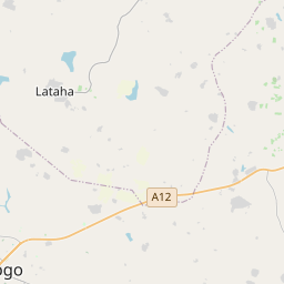
Korhogo on the map

Data Sources & Methodology

Our weather forecasts are powered by a professional weather data provider that aggregates data from national weather services, satellite observations, radar networks, and over 80,000 weather stations worldwide. Forecast data is updated multiple times daily. We convert raw data into clear summaries — wind speed in m/s, pressure in mmHg — so you can plan your day with confidence.