5-day weather forecast Korhogo Nov 16, 2026

33°23° · Partly cloudy

Weather forecast Korhogo tomorrow Nov 16, 2026: partly cloudy, temperature from 23 °C to 33 °C.

Precipitation probability 12%. Wind up to 2.19 m/s (gusts 4.56 m/s). Air humidity 41–81%, atmospheric pressure 758–761 mm Hg, UV index up to 9.6.

Sunrise 06:16
Sunset 17:57
First Quarter52% illuminated
Moonrise 12:14 · Moonset does not set today
Chart
Table

Forecast from 23 °C to 33 °C and precipitation

Temperature & Precipitation
Time00:0001:0002:0003:0004:0005:0006:0007:0008:0009:0010:0011:0012:0013:0014:0015:0016:0017:0018:0019:0020:0021:0022:0023:00
Temperature (°C)252524242423232425272930323333333232302928272726
Precipitation (mm/hr)000000000000.010.010.010.010.0100000000

Cloud cover and precipitation probability

Cloud cover & Rain chance
Time00:0001:0002:0003:0004:0005:0006:0007:0008:0009:0010:0011:0012:0013:0014:0015:0016:0017:0018:0019:0020:0021:0022:0023:00
Cloud cover (%)21111121313439485087758584754855684737434129
Rain chance (%)45678101212109711898746877898

Wind speed and direction

Wind & Wind gust
Time00:0001:0002:0003:0004:0005:0006:0007:0008:0009:0010:0011:0012:0013:0014:0015:0016:0017:0018:0019:0020:0021:0022:0023:00
Wind (m/s)1.311.311.311.51.51.611.691.692.112.191.811.3910.810.810.890.890.610.310.691.111.191.311.5
Wind gust (m/s)2.562.392.1922.112.53.444.364.534.564.224.034.033.943.673.53.192.52.062.362.472.422.362.36
Wind direction (°)S 170°S 190°SSW 206°SW 217°SSW 210°SSW 201°SSW 196°S 191°S 189°S 189°S 185°S 180°S 172°SE 145°ESE 120°ESE 107°ESE 111°ESE 118°S 175°SSW 200°SSW 194°SSW 195°SSW 192°SSW 192°

Air humidity

Humidity
Time00:0001:0002:0003:0004:0005:0006:0007:0008:0009:0010:0011:0012:0013:0014:0015:0016:0017:0018:0019:0020:0021:0022:0023:00
Humidity (%)666971747678817973676054484442414551576064687071

Atmospheric pressure

Pressure
Time00:0001:0002:0003:0004:0005:0006:0007:0008:0009:0010:0011:0012:0013:0014:0015:0016:0017:0018:0019:0020:0021:0022:0023:00
Pressure (mm Hg)760760759759759759760760761761761761760759758758758758758758759760760760

Ultraviolet index

UV Index
Time00:0001:0002:0003:0004:0005:0006:0007:0008:0009:0010:0011:0012:0013:0014:0015:0016:0017:0018:0019:0020:0021:0022:0023:00
UV Index00000000.10.92.85.489.69.37.54.72.20.6000000

Air quality & pollen

Air quality
Time00:0001:0002:0003:0004:0005:0006:0007:0008:0009:0010:0011:0012:0013:0014:0015:0016:0017:0018:0019:0020:0021:0022:0023:00
PM2.5 (µg/m³)18.5191918.517.817.217.11816.615.414.313.913.713.714.213.513.21313.915.716.817.217.817.7
PM10 (µg/m³)3636.636.335.233.63230.730.52726.125.326.326.526.627.325.724.723.623.1252626.126.526
Ozone (O₃) (µg/m³)3936333128252842617785909498100999385766860545047
NO₂ (µg/m³)1010.510.710.710.610.39.3741.70.80.60.50.30.20.51.32.43.65.16.67.77.97.6
SO₂ (µg/m³)110.90.80.80.70.70.70.60.60.60.50.50.50.50.50.50.50.60.70.9110.9
CO (µg/m³)223216206202209221226218203191185180178175173179200228246244231217204189

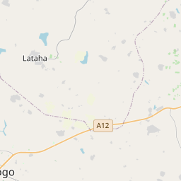
Korhogo on the map

Data Sources & Methodology

Our weather forecasts are powered by a professional weather data provider that aggregates data from national weather services, satellite observations, radar networks, and over 80,000 weather stations worldwide. Forecast data is updated multiple times daily. We convert raw data into clear summaries — wind speed in m/s, pressure in mmHg — so you can plan your day with confidence.