
5-Tage-Wettervorhersage Zakopane 17. Okt. 2026

7°1° · Bedeckt

Wettervorhersage Zakopane Samstag 17. Okt. 2026: bedeckt, Temperatur von 1 °C bis 7 °C.

Niederschlagswahrscheinlichkeit 58%. Wind bis zu 1.19 m/s (Böen 4.69 m/s). Luftfeuchtigkeit 59–99%, Luftdruck 764–767 mm Hg, UV-Index bis 1.2.

Wetterwarnungen

Moderate13. Okt., 22:05 — 14. Okt., 19:00Mit Google übersetzen
Yellow Strong wind in the coastal zone warning for Poland - Eastern coastal zone

Yellow Wind warning

Wind south veering west to northwest force 5 to 7.
BE AWARE. Difficult navigation conditions. It is recommended to avoid traveling through coastal zone area.
Moderate13. Okt., 21:21 — 14. Okt., 21:00Mit Google übersetzen
Yellow Strong wind warning for Poland - Zachodniopomorskie Province Slawienski County

Yellow Wind warning

It is forecasted strong wind with mean speed to 40 km/h and gusts up to 75 km/h, from northwest.
BE AWARE of debris being blown around. Localised outdoor activity disruption is possible due to debris.
Moderate13. Okt., 21:21 — 14. Okt., 21:00Mit Google übersetzen
Yellow Strong wind warning for Poland - Zachodniopomorskie Province Koszalinski County

Yellow Wind warning

It is forecasted strong wind with mean speed to 40 km/h and gusts up to 75 km/h, from northwest.
BE AWARE of debris being blown around. Localised outdoor activity disruption is possible due to debris.
Moderate13. Okt., 21:21 — 14. Okt., 21:00Mit Google übersetzen
Yellow Strong wind warning for Poland - Zachodniopomorskie Province Kolobrzeski County

Yellow Wind warning

It is forecasted strong wind with mean speed to 40 km/h and gusts up to 75 km/h, from northwest.
BE AWARE of debris being blown around. Localised outdoor activity disruption is possible due to debris.
Moderate13. Okt., 21:21 — 14. Okt., 21:00Mit Google übersetzen
Yellow Strong wind warning for Poland - Pomorskie Province Wejherowski County

Yellow Wind warning

It is forecasted strong wind with mean speed to 40 km/h and gusts up to 75 km/h, from northwest.
BE AWARE of debris being blown around. Localised outdoor activity disruption is possible due to debris.
5 Tage im Überblick — tippen Sie auf einen Tag, um ihn zu öffnen
Sonnenaufgang 07:04
Sonnenuntergang 17:46
Erstes Viertel47% beleuchtet
Mondaufgang 14:27 · Monduntergang 22:12
Diagramm
Tabelle

Vorhersage von 1 °C bis 7 °C und Niederschlag

Temperatur & Niederschlag
Uhrzeit00:0001:0002:0003:0004:0005:0006:0007:0008:0009:0010:0011:0012:0013:0014:0015:0016:0017:0018:0019:0020:0021:0022:0023:00
Temperatur (°C)233212334676667666656666
Niederschlag (mm/Std.)0000000000.010.010.060.140.140.050.040.020.130.10.10.230.190.10.01

Bewölkung und Niederschlagswahrscheinlichkeit

Bewölkung & Regenwahrscheinlichkeit
Uhrzeit00:0001:0002:0003:0004:0005:0006:0007:0008:0009:0010:0011:0012:0013:0014:0015:0016:0017:0018:0019:0020:0021:0022:0023:00
Bewölkung (%)9610071399399100100100100100100100100100100100100100100100100100100
Regenwahrscheinlichkeit (%)16151061515161718202231404237434455545458565444

Windgeschwindigkeit und -richtung

Wind & Windböe
Uhrzeit00:0001:0002:0003:0004:0005:0006:0007:0008:0009:0010:0011:0012:0013:0014:0015:0016:0017:0018:0019:0020:0021:0022:0023:00
Wind (m/s)0.390.890.890.810.190.50.690.390.310.610.690.50.390.690.6911.111.111.191.191.191.111.191.11
Windböe (m/s)0.533.890.920.810.310.614.690.420.310.8110.610.610.830.971.361.51.611.861.891.831.721.891.61
Windrichtung (°)SO 126°OSO 102°SO 143°SSW 207°SW 232°WSW 251°NNW 337°NNW 338°N 4°N 350°N 4°N 349°NNW 340°NW 317°NW 325°NNW 337°NNW 339°NNW 339°N 350°N 355°N 4°N 5°N 5°N 357°

Luftfeuchtigkeit

Feuchtigkeit
Uhrzeit00:0001:0002:0003:0004:0005:0006:0007:0008:0009:0010:0011:0012:0013:0014:0015:0016:0017:0018:0019:0020:0021:0022:0023:00
Feuchtigkeit (%)646159606261626467717581868992959798999999999999

Luftdruck

Druck
Uhrzeit00:0001:0002:0003:0004:0005:0006:0007:0008:0009:0010:0011:0012:0013:0014:0015:0016:0017:0018:0019:0020:0021:0022:0023:00
Druck (mm Hg)767767766766766765765765765764764764764764764764764764764764765765765765

Ultraviolett-Index

UV-Index
Uhrzeit00:0001:0002:0003:0004:0005:0006:0007:0008:0009:0010:0011:0012:0013:0014:0015:0016:0017:0018:0019:0020:0021:0022:0023:00
UV-Index0000000000.411.20.60.30.40.40.40.1000000

Luftqualität & Pollen

Luftqualitätsdaten sind nur für die ersten drei Tage verfügbar.

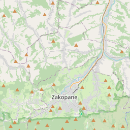
Zakopane auf der Karte
Datenquellen & Methodik

Unsere Wettervorhersagen werden von einem professionellen Wetterdatenanbieter bereitgestellt, der Daten von nationalen Wetterdiensten, Satellitenbeobachtungen, Radarnetzwerken und über 80.000 Wetterstationen weltweit zusammenführt. Die Vorhersagedaten werden mehrmals täglich aktualisiert. Wir wandeln Rohdaten in übersichtliche Zusammenfassungen um – Windgeschwindigkeit in m/s, Luftdruck in mmHg – damit Sie Ihren Tag mit Zuversicht planen können.