5-Tage-Wettervorhersage San Diego 28-07-2026

Wettervorhersage San Diego morgen 28.07.2026: sonnig, Temperatur von 20 °C bis 26 °C.

Niederschlagswahrscheinlichkeit 33%. Wind bis zu 4.11 m/s (Böen 4.72 m/s). Luftfeuchtigkeit 58–95%, Luftdruck 757–759 mm Hg, UV-Index bis 10.4.

Wetterwarnungen

Warnungen ausblenden
Moderate27. Juli, 05:2427. Juli, 19:00Mit Google übersetzen
Heat Advisory issued July 27 at 5:24AM PDT until July 27 at 8:00PM PDT by NWS San Diego CA

Heat Advisory

* WHAT...High temperatures in the mid 80s for the mesas and low temperatures in the upper 60s and lower 70s. * WHERE...San Diego County Coastal Areas. * WHEN...Until 8 PM PDT this evening. * IMPACTS...Hot temperatures may cause heat illnesses.
Drink plenty of fluids, stay in an air-conditioned room, stay out of the sun, and check up on relatives and neighbors.
Moderate27. Juli, 05:2427. Juli, 19:00Mit Google übersetzen
Heat Advisory issued July 27 at 5:24AM PDT until July 27 at 8:00PM PDT by NWS San Diego CA

Heat Advisory

* WHAT...High temperatures in the upper 80s to upper 90s and low temperatures in the upper 60s to low 70s. * WHERE...San Diego County Valleys. * WHEN...Until 8 PM PDT this evening. * IMPACTS...Hot temperatures may cause heat illnesses.
Drink plenty of fluids, stay in an air-conditioned room, stay out of the sun, and check up on relatives and neighbors.
Moderate27. Juli, 05:2427. Juli, 19:00Mit Google übersetzen
Heat Advisory issued July 27 at 5:24AM PDT until July 27 at 8:00PM PDT by NWS San Diego CA

Heat Advisory

* WHAT...Temperatures in the mid to upper 90s with low temperatures in the upper 60s to low 70s. * WHERE...San Diego County Mountains. * WHEN...Until 8 PM PDT this evening. * IMPACTS...Hot temperatures may cause heat illnesses.
Drink plenty of fluids, stay in an air-conditioned room, stay out of the sun, and check up on relatives and neighbors.
Minor27. Juli, 13:3627. Juli, 21:45Mit Google übersetzen
Coastal Flood Advisory issued July 27 at 1:36PM PDT until August 1 at 3:00AM PDT by NWS San Diego CA

Coastal Flood Advisory

* WHAT...For the Beach Hazards Statement, 3-6 feet with sets to 7 feet expected. For the Coastal Flood Advisory, minor coastal flooding expected. For the High Surf Advisory, large breaking waves of 5-8 feet with sets up to 9 feet on south-southwest facing beaches and 3-6 feet on west-facing beaches. * WHERE...San Diego County Coastal Areas and Orange County Coastal Areas. * WHEN...For the Beach Hazards Statement, through Wednesday afternoon. For the Coastal Flood Advisory, from 5 PM Wednesday to 3 AM PDT Saturday. For the High Surf Advisory, from 5 PM Wednesday to 5 PM PDT Saturday. * IMPACTS...Flooding of lots, parks, and roads with only isolated road closures expected. Dangerous swimming and surfing conditions and localized beach erosion. Breaking waves can sweep people off jetties and docks, and into dangerous seas. * ADDITIONAL DETAILS...A long period southerly swell of 3 feet at 17 seconds continues through Wednesday. A higher amplitude swell associated with Hurricane Genevieve of around 5 feet at 14 seconds builds late Wednesday into Thursday. Swell and associated surf look to subside late Saturday into Sunday. Also, the following are the evening high tides for La Jolla: Wednesday: 6.11 ft at 9:36 PM PDT Thursday: 5.96 ft at 10:08 PM PDT Friday: 5.65 ft at 10:41 PM PDT Note, tides have been chronically underpredicted this summer, with observed tides at La Jolla generally 0.3-0.4 ft higher than these predictions.
Inexperienced swimmers should remain out of the water due to dangerous surf conditions.
Minor27. Juli, 13:3627. Juli, 21:45Mit Google übersetzen
High Surf Advisory issued July 27 at 1:36PM PDT until August 1 at 5:00PM PDT by NWS San Diego CA

High Surf Advisory

* WHAT...For the Beach Hazards Statement, 3-6 feet with sets to 7 feet expected. For the Coastal Flood Advisory, minor coastal flooding expected. For the High Surf Advisory, large breaking waves of 5-8 feet with sets up to 9 feet on south-southwest facing beaches and 3-6 feet on west-facing beaches. * WHERE...San Diego County Coastal Areas and Orange County Coastal Areas. * WHEN...For the Beach Hazards Statement, through Wednesday afternoon. For the Coastal Flood Advisory, from 5 PM Wednesday to 3 AM PDT Saturday. For the High Surf Advisory, from 5 PM Wednesday to 5 PM PDT Saturday. * IMPACTS...Flooding of lots, parks, and roads with only isolated road closures expected. Dangerous swimming and surfing conditions and localized beach erosion. Breaking waves can sweep people off jetties and docks, and into dangerous seas. * ADDITIONAL DETAILS...A long period southerly swell of 3 feet at 17 seconds continues through Wednesday. A higher amplitude swell associated with Hurricane Genevieve of around 5 feet at 14 seconds builds late Wednesday into Thursday. Swell and associated surf look to subside late Saturday into Sunday. Also, the following are the evening high tides for La Jolla: Wednesday: 6.11 ft at 9:36 PM PDT Thursday: 5.96 ft at 10:08 PM PDT Friday: 5.65 ft at 10:41 PM PDT Note, tides have been chronically underpredicted this summer, with observed tides at La Jolla generally 0.3-0.4 ft higher than these predictions.
Inexperienced swimmers should remain out of the water due to dangerous surf conditions.
5 Tage im Überblick — tippen Sie auf einen Tag, um ihn zu öffnen
Sonnenaufgang 06:00
Sonnenuntergang 19:50
Vollmond100% beleuchtet
Mondaufgang 19:47 · Monduntergang 05:14
Diagramm
Tabelle

Vorhersage von 20 °C bis 26 °C und Niederschlag

Temperatur & Niederschlag
Uhrzeit00:0001:0002:0003:0004:0005:0006:0007:0008:0009:0010:0011:0012:0013:0014:0015:0016:0017:0018:0019:0020:0021:0022:0023:00
Temperatur (°C)202020202022222223232425252526262525242423232322
Niederschlag (mm/Std.)000000000000000000000000

Bewölkung und Niederschlagswahrscheinlichkeit

Bewölkung & Regenwahrscheinlichkeit
Uhrzeit00:0001:0002:0003:0004:0005:0006:0007:0008:0009:0010:0011:0012:0013:0014:0015:0016:0017:0018:0019:0020:0021:0022:0023:00
Bewölkung (%)1001001001001000242200000000000000
Regenwahrscheinlichkeit (%)33333232338998754433333344556

Windgeschwindigkeit und -richtung

Wind & Windböe
Uhrzeit00:0001:0002:0003:0004:0005:0006:0007:0008:0009:0010:0011:0012:0013:0014:0015:0016:0017:0018:0019:0020:0021:0022:0023:00
Wind (m/s)1.691.691.391.8111.391.811.812.312.693.113.613.613.814.113.813.813.613.312.612.312.112.52.69
Windböe (m/s)2.192.221.832.331.281.862.362.282.813.113.584.144.144.364.724.364.364.143.8132.782.583.143.36
Windrichtung (°)SSW 204°SW 219°SW 225°SW 224°WSW 250°SW 220°SW 232°SW 221°SSW 203°SSW 207°SSW 209°SW 221°SW 224°SW 226°SW 231°SW 231°SW 232°SW 230°SW 229°SW 227°SW 216°SSW 201°SSW 194°SSW 200°

Luftfeuchtigkeit

Feuchtigkeit
Uhrzeit00:0001:0002:0003:0004:0005:0006:0007:0008:0009:0010:0011:0012:0013:0014:0015:0016:0017:0018:0019:0020:0021:0022:0023:00
Feuchtigkeit (%)959594949578797977746966636059585859616365676971

Luftdruck

Druck
Uhrzeit00:0001:0002:0003:0004:0005:0006:0007:0008:0009:0010:0011:0012:0013:0014:0015:0016:0017:0018:0019:0020:0021:0022:0023:00
Druck (mm Hg)759759758758758758758758759759759759759758758758758757757757758758758758

Ultraviolett-Index

UV-Index
Uhrzeit00:0001:0002:0003:0004:0005:0006:0007:0008:0009:0010:0011:0012:0013:0014:0015:0016:0017:0018:0019:0020:0021:0022:0023:00
UV-Index00000000.41.33.15.58.29.810.49.67.54.82.50.90.20000

Luftqualität & Pollen

Luftqualität
Uhrzeit00:0001:0002:0003:0004:0005:0006:0007:0008:0009:0010:0011:0012:0013:0014:0015:0016:0017:0018:0019:0020:0021:0022:0023:00
PM2.5 (µg/m³)1212.213.815.316.617.618.217.915.515.315.816.416.716.415.71514.714.614.614.414.113.912.611.4
PM10 (µg/m³)15.715.417.319.120.421.221.720.519.520.321.422.623.623.722.92221.521.12120.519.919.617.314.8
Ozon (O₃) (µg/m³)16118657132130405061738491918882756657494033
NO₂ (µg/m³)3236.439.541.44240.635.929.12318.815.412.18.65.332.12.23.25.1811.215.119.323.1
SO₂ (µg/m³)1.61.51.41.41.41.41.51.71.92.12.22.21.91.51.210.90.90.911.11.21.41.5
CO (µg/m³)989798105115120113100929398101979187878890929598102106109

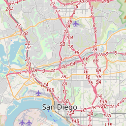
San Diego auf der Karte

Datenquellen & Methodik

Unsere Wettervorhersagen werden von einem professionellen Wetterdatenanbieter bereitgestellt, der Daten von nationalen Wetterdiensten, Satellitenbeobachtungen, Radarnetzwerken und über 80.000 Wetterstationen weltweit zusammenführt. Die Vorhersagedaten werden mehrmals täglich aktualisiert. Wir wandeln Rohdaten in übersichtliche Zusammenfassungen um – Windgeschwindigkeit in m/s, Luftdruck in mmHg – damit Sie Ihren Tag mit Zuversicht planen können.