5-Tage-Wettervorhersage Niagara Falls 16-06-2026

Wettervorhersage Niagara Falls morgen 16.06.2026: sonnig, Temperatur von 15 °C bis 21 °C.

Niederschlagswahrscheinlichkeit 7%. Wind bis zu 6.89 m/s (Böen 8.92 m/s). Luftfeuchtigkeit 48–83%, Luftdruck 755–758 mm Hg, UV-Index bis 7.5.

Wetterwarnungen

Warnungen ausblenden
SevereJun 14, 06:00 PMJun 15, 03:59 AMMit Google übersetzen
squall watch in effect

squall — Service Notice – April 2026: The Environment and Climate Change Canada (ECCC) CAP Service undergoes changes from time to time as the business of alerting evolves. For Spring 2026, changes are expected to include... 1) ECCC's initiative to introduce free-form polygons to represent the true threat area of a weather hazard is tentatively set for June 2026 deployment. Data changes will appear in CAP following this deployment, 2) marine alerts will now be issued for smaller zone splits in certain areas of Atlantic and Pacific waters and 3) other minor improvements and corrections. For more information on these changes: https://comm.collab.science.gc.ca/mailman3/hyperkitty/list/dd_info@comm.collab.science.gc.ca/ | Notification de service – avril 2026: Le service du PAC d’Environnement et Changement climatique Canada (ECCC) subit périodiquement des changements à mesure que le système d’alerte évolue. Pour le printemps 2026, il y aura des changements incluant... 1) l’initiative d’ECCC visant à introduire des polygones libres pour représenter la véritable zone de menace d’un danger météorologique devrait être déployée provisoirement en juin 2026. Des changements de données apparaîtront dans le PAC à la suite de ce déploiement, 2) les alertes marines seront désormais émises pour des subdivisions de zones plus petites dans certaines régions des eaux de l’Atlantique et du Pacifique et 3) d’autres améliorations et corrections mineures. Pour plus d’informations sur ces changements: https://comm.collab.science.gc.ca/mailman3/hyperkitty/list/dd_info@comm.collab.science.gc.ca/

Thunderstorms are expected to affect the area through early this evening. Some of these thunderstorms may be capable of producing squalls with wind gusts up to 40 knots and small hail. ### Please continue to monitor alerts and forecasts issued by Environment Canada. For more information monitor Canadian Coast Guard radio or Weatheradio stations.
SevereJun 14, 03:14 PMJun 15, 04:00 AMMit Google übersetzen
squall watch in effect

squall — Service Notice – April 2026: The Environment and Climate Change Canada (ECCC) CAP Service undergoes changes from time to time as the business of alerting evolves. For Spring 2026, changes are expected to include... 1) ECCC's initiative to introduce free-form polygons to represent the true threat area of a weather hazard is tentatively set for June 2026 deployment. Data changes will appear in CAP following this deployment, 2) marine alerts will now be issued for smaller zone splits in certain areas of Atlantic and Pacific waters and 3) other minor improvements and corrections. For more information on these changes: https://comm.collab.science.gc.ca/mailman3/hyperkitty/list/dd_info@comm.collab.science.gc.ca/ | Notification de service – avril 2026: Le service du PAC d’Environnement et Changement climatique Canada (ECCC) subit périodiquement des changements à mesure que le système d’alerte évolue. Pour le printemps 2026, il y aura des changements incluant... 1) l’initiative d’ECCC visant à introduire des polygones libres pour représenter la véritable zone de menace d’un danger météorologique devrait être déployée provisoirement en juin 2026. Des changements de données apparaîtront dans le PAC à la suite de ce déploiement, 2) les alertes marines seront désormais émises pour des subdivisions de zones plus petites dans certaines régions des eaux de l’Atlantique et du Pacifique et 3) d’autres améliorations et corrections mineures. Pour plus d’informations sur ces changements: https://comm.collab.science.gc.ca/mailman3/hyperkitty/list/dd_info@comm.collab.science.gc.ca/

Thunderstorms are expected to affect the area through early this evening. Some of these thunderstorms may be capable of producing squalls with wind gusts up to 40 knots and small hail. ### Please continue to monitor alerts and forecasts issued by Environment Canada. For more information monitor Canadian Coast Guard radio or Weatheradio stations.
Mariners are advised to prepare for potential squalls. Vulnerable vessels are most at risk and should seek safe harbour if underway.
ModerateJun 14, 08:09 PMJun 15, 08:00 AMMit Google übersetzen
Beach Hazards Statement issued June 14 at 4:09PM EDT until June 15 at 10:00AM EDT by NWS Buffalo NY

Beach Hazards Statement

* WHAT...Strong currents and dangerous swimming conditions expected. * WHERE...Beaches of Niagara and Orleans counties. * WHEN...From 1 AM EDT Monday through Monday morning. * IMPACTS...Strong currents and dangerous swimming conditions.
Stay out of the water to avoid dangerous swimming conditions.
Sonnenaufgang 05:36
Sonnenuntergang 20:57
Zunehmende Sichel6% beleuchtet
Mondaufgang 06:29 · Monduntergang 22:48
Diagramm
Tabelle

Vorhersage von 15 °C bis 21 °C und Niederschlag

Temperatur & Niederschlag
Uhrzeit00:0001:0002:0003:0004:0005:0006:0007:0008:0009:0010:0011:0012:0013:0014:0015:0016:0017:0018:0019:0020:0021:0022:0023:00
Temperatur (°C)151515151515151516181819202121212121201918181717
Niederschlag (mm/Std.)00000000000.040.050.020.010000000000

Bewölkung und Niederschlagswahrscheinlichkeit

Bewölkung & Regenwahrscheinlichkeit
Uhrzeit00:0001:0002:0003:0004:0005:0006:0007:0008:0009:0010:0011:0012:0013:0014:0015:0016:0017:0018:0019:0020:0021:0022:0023:00
Bewölkung (%)1415161921181371317738689742519161181220151219
Regenwahrscheinlichkeit (%)77779111198614171393322346668

Windgeschwindigkeit und -richtung

Wind & Windböe
Uhrzeit00:0001:0002:0003:0004:0005:0006:0007:0008:0009:0010:0011:0012:0013:0014:0015:0016:0017:0018:0019:0020:0021:0022:0023:00
Wind (m/s)4.194.114.394.54.113.813.613.5455.395.56.316.816.616.896.896.115.6154.53.693.813.89
Windböe (m/s)7.617.677.898.117.587.146.816.065.946.897.257.227.928.198.148.538.928.3987.867.947.477.978.17
Windrichtung (°)SSW 210°SSW 208°SSW 212°SSW 212°SSW 207°SSW 213°SW 222°SW 223°SW 224°SW 223°SW 229°SW 232°SW 233°SW 234°SW 230°SW 225°SW 226°SW 220°SW 215°SSW 209°SSW 201°S 185°S 172°S 172°

Luftfeuchtigkeit

Feuchtigkeit
Uhrzeit00:0001:0002:0003:0004:0005:0006:0007:0008:0009:0010:0011:0012:0013:0014:0015:0016:0017:0018:0019:0020:0021:0022:0023:00
Feuchtigkeit (%)737370707580838074686361575351494850545964687173

Luftdruck

Druck
Uhrzeit00:0001:0002:0003:0004:0005:0006:0007:0008:0009:0010:0011:0012:0013:0014:0015:0016:0017:0018:0019:0020:0021:0022:0023:00
Druck (mm Hg)758758757757757757757757757757756756756756755755755755755755755755755755

Ultraviolett-Index

UV-Index
Uhrzeit00:0001:0002:0003:0004:0005:0006:0007:0008:0009:0010:0011:0012:0013:0014:0015:0016:0017:0018:0019:0020:0021:0022:0023:00
UV-Index00000000.30.92.13.55.46.97.57.36.44.931.50.60.2000

Luftqualität & Pollen

Luftqualität
Uhrzeit00:0001:0002:0003:0004:0005:0006:0007:0008:0009:0010:0011:0012:0013:0014:0015:0016:0017:0018:0019:0020:0021:0022:0023:00
PM2.5 (µg/m³)5.75.55.45.254.74.64.95.466.77.27.376.96.86.15.34.74.84.94.94.95
PM10 (µg/m³)6.15.85.75.55.24.94.85.15.66.26.97.37.57.176.96.25.54.9555.15.15.2
Ozon (O₃) (µg/m³)66758181787572696768717582919910511011211010599928479
NO₂ (µg/m³)11.28.36.25.766.477.78.187.6764.73.83.333.34.467.27.57.36.9
SO₂ (µg/m³)2.42.12222.12.12.22.22.32.42.52.42.32.11.91.71.61.61.61.61.41.11
CO (µg/m³)143125112106105106110117123127130132131130128127126128136147156161163162

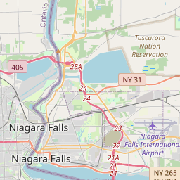
Niagara Falls auf der Karte

Datenquellen & Methodik

Unsere Wettervorhersagen werden von einem professionellen Wetterdatenanbieter bereitgestellt, der Daten von nationalen Wetterdiensten, Satellitenbeobachtungen, Radarnetzwerken und über 80.000 Wetterstationen weltweit zusammenführt. Die Vorhersagedaten werden mehrmals täglich aktualisiert. Wir wandeln Rohdaten in übersichtliche Zusammenfassungen um – Windgeschwindigkeit in m/s, Luftdruck in mmHg – damit Sie Ihren Tag mit Zuversicht planen können.