5-Tage-Wettervorhersage Exeter 24-06-2026

Wettervorhersage Exeter Mittwoch, 24. Juni 24.06.2026: sonnig, Temperatur von 20 °C bis 31 °C.

Niederschlagswahrscheinlichkeit 12%. Wind bis zu 4.61 m/s (Böen 6.08 m/s). Luftfeuchtigkeit 49–90%, Luftdruck 761–764 mm Hg, UV-Index bis 7.4.

Wetterwarnungen

Warnungen ausblenden
SevereJun 22, 12:00 AMJun 23, 10:59 PMMit Google übersetzen
A developing hot spell through Monday and Tuesday will likely lead to widespread impacts on people and infrastructure.: UPDATED

Amber extreme_heat warning

Information on update: Area expanded across east Wales and much of the Midlands. Some updates to the 'further details' too. Following very warm weather on Sunday, very high temperatures, accompanied by high humidity, are expected on Monday and especially Tuesday and will likely bring widespread impacts to people and infrastructure. In addition to high daytime maxima, temperatures overnight will remain very warm, especially in larger urban areas. Temperatures are likely to reach the low to mid-30s Celsius in places on Monday and into the mid-30s Celsius more widely on Tuesday. Some places, particularly in urban areas, may see temperatures remain above 20 Celsius overnight. The very high temperatures are likely to continue across parts of central and southern Britain further on into next week, albeit with some uncertainty in the extent and magnitude of this heat. For further details see https://www.metoffice.gov.uk/weather/warnings-and-advice/uk-warnings
Keep yourself safe by following these simple steps to reduce the likelihood of the heat making you feel unwell; drink plenty of fluids, keep out of the sun and avoid any exercise between 11am-3pm when the sun is strongest and close curtains in rooms that face the sun. If you are going out take water with you, stay in the shade, wear sunscreen and a wide brimmed hat. Give yourself the best chance of avoiding delays by checking road conditions if driving, or bus and train timetables, amending your travel plans if necessary. If using public transport, there are many simple things you can do to keep yourself safe; carry water with you, take a small hand-held battery powered fan, if you feel unwell get off at next stop for some fresh air, dress in light fabrics in light colours to help stay cooler, keep an eye on fellow passengers for signs they may be struggling. Help to protect vulnerable people that you know including older people, those with underlying conditions and those who live alone; they may need support to keep cool and stay hydrated. If you are worried about your health, or that of somebody you know, ring NHS 111. Keep yourself safe whilst enjoying the water in this weather by following these simple steps: enter the water gradually, avoiding jumping or diving straight in, to reduce your risk of cold-water shock, go to a lifeguarded beach or a supervised swimming area, and, if you, or anyone else, get into difficulty in the water, float on your back. People cope better with power cuts when they have prepared for them in advance. It’s easy to do; consider gathering torches and batteries, a mobile phone power pack and other essential items. Stay up to date with the weather forecast for your area and follow any advice from emergency services and local authorities
Sonnenaufgang 05:01
Sonnenuntergang 21:31
Zunehmender Mond79% beleuchtet
Mondaufgang 16:42 · Monduntergang 01:26
Diagramm
Tabelle

Vorhersage von 20 °C bis 31 °C und Niederschlag

Temperatur & Niederschlag
Uhrzeit00:0001:0002:0003:0004:0005:0006:0007:0008:0009:0010:0011:0012:0013:0014:0015:0016:0017:0018:0019:0020:0021:0022:0023:00
Temperatur (°C)212020202020202325272829303031313130302927242321
Niederschlag (mm/Std.)000000000000000000000000

Bewölkung und Niederschlagswahrscheinlichkeit

Bewölkung & Regenwahrscheinlichkeit
Uhrzeit00:0001:0002:0003:0004:0005:0006:0007:0008:0009:0010:0011:0012:0013:0014:0015:0016:0017:0018:0019:0020:0021:0022:0023:00
Bewölkung (%)00455591819161719202128464446328132053
Regenwahrscheinlichkeit (%)12121213131413128654433445424557

Windgeschwindigkeit und -richtung

Wind & Windböe
Uhrzeit00:0001:0002:0003:0004:0005:0006:0007:0008:0009:0010:0011:0012:0013:0014:0015:0016:0017:0018:0019:0020:0021:0022:0023:00
Wind (m/s)1.690.890.6922.52.52.892.612.392.813.694.614.54.194.194.1143.8932.191.111.112.392.11
Windböe (m/s)3.581.891.474.195.255.256.0853.253.564.425.365.194.834.834.834.895.114.223.472.252.315.034.42
Windrichtung (°)NNW 342°N 359°N 11°N 357°N 349°N 355°N 0°N 9°NNO 32°ONO 71°O 93°OSO 112°OSO 115°OSO 119°SO 125°SO 131°SO 136°SO 136°SO 134°OSO 118°OSO 122°ONO 73°S 174°SO 138°

Luftfeuchtigkeit

Feuchtigkeit
Uhrzeit00:0001:0002:0003:0004:0005:0006:0007:0008:0009:0010:0011:0012:0013:0014:0015:0016:0017:0018:0019:0020:0021:0022:0023:00
Feuchtigkeit (%)888888888990898374686460575552495051515263656773

Luftdruck

Druck
Uhrzeit00:0001:0002:0003:0004:0005:0006:0007:0008:0009:0010:0011:0012:0013:0014:0015:0016:0017:0018:0019:0020:0021:0022:0023:00
Druck (mm Hg)763764764763763763763763763764764763763763763763762762762761761762762763

Ultraviolett-Index

UV-Index
Uhrzeit00:0001:0002:0003:0004:0005:0006:0007:0008:0009:0010:0011:0012:0013:0014:0015:0016:0017:0018:0019:0020:0021:0022:0023:00
UV-Index0000000.10.51.22.445.56.87.47.26.24.73.21.80.80.3000

Luftqualität & Pollen

Luftqualität
Uhrzeit00:0001:0002:0003:0004:0005:0006:0007:0008:0009:0010:0011:0012:0013:0014:0015:0016:0017:0018:0019:0020:0021:0022:0023:00
PM2.5 (µg/m³)17.31820.922.223.123.623.920.6161819.420.320.620.52019.418.717.917.517.517.81818.518.5
PM10 (µg/m³)26.228.732.935.637.338.438.933.528.433.939.542.543.442.841.840.439.238.137.53836.434.834.336.9
Ozon (O₃) (µg/m³)7673.58088939187869199107113118122123123122122120116105918181
NO₂ (µg/m³)12.917.220.818.716.815.81513.510.77.34.63.12.31.81.51.41.51.61.82.95.79.311.812.3
SO₂ (µg/m³)1.21.72.22.121.91.81.71.61.51.41.31.110.90.90.90.90.90.911.21.41.5
CO (µg/m³)119.5138.2160.5184.5207206206203195184175171168167166166166165165167174183189189

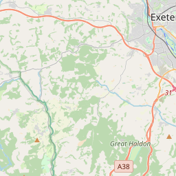
Exeter auf der Karte

Datenquellen & Methodik

Unsere Wettervorhersagen werden von einem professionellen Wetterdatenanbieter bereitgestellt, der Daten von nationalen Wetterdiensten, Satellitenbeobachtungen, Radarnetzwerken und über 80.000 Wetterstationen weltweit zusammenführt. Die Vorhersagedaten werden mehrmals täglich aktualisiert. Wir wandeln Rohdaten in übersichtliche Zusammenfassungen um – Windgeschwindigkeit in m/s, Luftdruck in mmHg – damit Sie Ihren Tag mit Zuversicht planen können.