5-Tage-Wettervorhersage Cold Lake 18. Nov. 2026

3°-3° · Teilweise bewölkt

Wettervorhersage Cold Lake Mittwoch 18. Nov. 2026: teilweise bewölkt, Temperatur von -3 °C bis 3 °C.

Niederschlagswahrscheinlichkeit 17%. Wind bis zu 2.39 m/s (Böen 4.97 m/s). Luftfeuchtigkeit 64–90%, Luftdruck 762–766 mm Hg, UV-Index bis 2.

Wetterwarnungen

Moderate13. Nov., 21:11 — 14. Nov., 13:11Mit Google übersetzen
yellow advisory - fog - in effect

fog

Areas of dense fog are expected or occurring. Conditions are expected to improve on Saturday. ### Visibility will likely be suddenly reduced at times. Please continue to monitor alerts and forecasts issued by Environment Canada. To report severe weather, send an email to ABstorm@ec.gc.ca, call 1-800-239-0484 or post reports on social media using #ABStorm.
Be prepared for areas of near-zero visibility and allow extra time to reach your destination. If driving, turn on your lights, slow down and maintain a safe following distance.
Moderate14. Nov., 08:17 — 14. Nov., 18:00Mit Google übersetzen
yellow advisory - fog - in effect

fog

Areas of dense fog are expected or occurring. Conditions are expected to improve later today. ### Visibility will likely be suddenly reduced at times. Please continue to monitor alerts and forecasts issued by Environment Canada. To report severe weather, send an email to ABstorm@ec.gc.ca, call 1-800-239-0484 or post reports on social media using #ABStorm.
Be prepared for areas of near-zero visibility and allow extra time to reach your destination. If driving, turn on your lights, slow down and maintain a safe following distance.
Moderate14. Nov., 06:48 — 14. Nov., 18:01Mit Google übersetzen
yellow advisory - fog - in effect

fog

Areas of dense fog are expected or occurring. Conditions are expected to improve later today. ### Visibility will likely be suddenly reduced at times. Please continue to monitor alerts and forecasts issued by Environment Canada. To report severe weather, send an email to ABstorm@ec.gc.ca, call 1-800-239-0484 or post reports on social media using #ABStorm.
Be prepared for areas of near-zero visibility and allow extra time to reach your destination. If driving, turn on your lights, slow down and maintain a safe following distance.
5 Tage im Überblick — tippen Sie auf einen Tag, um ihn zu öffnen
Sonnenaufgang 08:56
Sonnenuntergang 17:15
Zunehmender Mond73% beleuchtet
Mondaufgang 14:57 · Monduntergang 01:32
Diagramm
Tabelle
Mi., 18. Nov. 2026

Vorhersage von -3 °C bis 3 °C und Niederschlag

Temperatur & Niederschlag
Uhrzeit00:0001:0002:0003:0004:0005:0006:0007:0008:0009:0010:0011:0012:0013:0014:0015:0016:0017:0018:0019:0020:0021:0022:0023:00
Temperatur (°C)-1-2-2-2-2-2-3-3-3-3-20112320-1-1-2-2-2-2
Niederschlag (mm/Std.)000000000000000000000000

Bewölkung und Niederschlagswahrscheinlichkeit

Bewölkung & Regenwahrscheinlichkeit
Uhrzeit00:0001:0002:0003:0004:0005:0006:0007:0008:0009:0010:0011:0012:0013:0014:0015:0016:0017:0018:0019:0020:0021:0022:0023:00
Bewölkung (%)39404040404031404032374040404035131081425353635
Regenwahrscheinlichkeit (%)1313141415151517171716131198779111213141414

Windgeschwindigkeit und -richtung

Wind & Windböe
Uhrzeit00:0001:0002:0003:0004:0005:0006:0007:0008:0009:0010:0011:0012:0013:0014:0015:0016:0017:0018:0019:0020:0021:0022:0023:00
Wind (m/s)2.392.112.1122.112.312.392.392.312.312.112.192.112.112.1121.811.611.391.311.311.311.191.31
Windböe (m/s)2.532.392.142.252.222.362.943.253.583.694.834.864.534.534.754.864.833.614.944.974.032.782.612.06
Windrichtung (°)W 270°W 272°W 262°W 260°W 265°W 268°W 274°W 279°W 280°WNW 283°WNW 282°WNW 287°WNW 290°WNW 287°WNW 285°WNW 283°W 280°WNW 282°WNW 292°WNW 293°WNW 292°WNW 286°WNW 283°W 274°

Luftfeuchtigkeit

Feuchtigkeit
Uhrzeit00:0001:0002:0003:0004:0005:0006:0007:0008:0009:0010:0011:0012:0013:0014:0015:0016:0017:0018:0019:0020:0021:0022:0023:00
Feuchtigkeit (%)788080818384868889908679747067646876828484838282

Luftdruck

Druck
Uhrzeit00:0001:0002:0003:0004:0005:0006:0007:0008:0009:0010:0011:0012:0013:0014:0015:0016:0017:0018:0019:0020:0021:0022:0023:00
Druck (mm Hg)762763763763763764764764764764764764764764764764764764765765766766766766

Ultraviolett-Index

UV-Index
Uhrzeit00:0001:0002:0003:0004:0005:0006:0007:0008:0009:0010:0011:0012:0013:0014:0015:0016:0017:0018:0019:0020:0021:0022:0023:00
UV-Index000000002222222220000000

Luftqualität & Pollen

Luftqualitätsdaten sind nur für die ersten drei Tage verfügbar.

Mi., 18. Nov. 2026

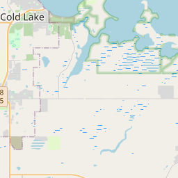
Cold Lake auf der Karte

Datenquellen & Methodik

Unsere Wettervorhersagen werden von einem professionellen Wetterdatenanbieter bereitgestellt, der Daten von nationalen Wetterdiensten, Satellitenbeobachtungen, Radarnetzwerken und über 80.000 Wetterstationen weltweit zusammenführt. Die Vorhersagedaten werden mehrmals täglich aktualisiert. Wir wandeln Rohdaten in übersichtliche Zusammenfassungen um – Windgeschwindigkeit in m/s, Luftdruck in mmHg – damit Sie Ihren Tag mit Zuversicht planen können.