5-Tage-Wettervorhersage Surry Hills 13. Nov. 2026

23°19° · Stellenweise Regen möglich

Wettervorhersage Surry Hills Freitag 13. Nov. 2026: stellenweise regen möglich, Temperatur von 19 °C bis 23 °C.

Niederschlagswahrscheinlichkeit 47%. Wind bis zu 9.19 m/s (Böen 15.22 m/s). Luftfeuchtigkeit 73–93%, Luftdruck 759–764 mm Hg, UV-Index bis 6.6.

Wetterwarnungen

Moderate10. Nov., 00:00 — 11. Nov., 00:00Mit Google übersetzen
Hazardous Surf Warning for Byron Coast: Point Danger to Wooli, Coffs Coast: Wooli to Smoky Cape, Macquarie Coast: Smoky Cape to Seal Rocks, Hunter Coast: Seal Rocks to Broken Bay, Sydney Coast: Broken Bay to Port Hacking, Illawarra Coast: Port Hacking to Ulladulla, Batemans Coast: Ulladulla to Montague Island and Eden Coast: Montague Island to Gabo Island for 10 November

Large Coastal Surf

NSW Police Force, Marine Area Command advise that: People should consider staying out of the water and avoid walking near surf-exposed areas. Rock fishers should avoid coastal rock platforms exposed to the ocean and seek a safe location that is sheltered from the surf. Boaters planning to cross shallow water and ocean bars should consider changing or delaying their voyage. Boaters already on the water should carry the appropriate safety equipment and wear a lifejacket. Boaters should remember to log on with their local Marine Rescue radio base, via VHF Radio or the Marine Rescue APP, and consider their safety management plan.
Moderate10. Nov., 00:00 — 11. Nov., 00:00Mit Google übersetzen
Hazardous Surf Warning for Byron Coast: Point Danger to Wooli, Coffs Coast: Wooli to Smoky Cape, Macquarie Coast: Smoky Cape to Seal Rocks, Hunter Coast: Seal Rocks to Broken Bay, Sydney Coast: Broken Bay to Port Hacking, Illawarra Coast: Port Hacking to Ulladulla, Batemans Coast: Ulladulla to Montague Island and Eden Coast: Montague Island to Gabo Island for 10 November

Large Coastal Surf

NSW Police Force, Marine Area Command advise that: People should consider staying out of the water and avoid walking near surf-exposed areas. Rock fishers should avoid coastal rock platforms exposed to the ocean and seek a safe location that is sheltered from the surf. Boaters planning to cross shallow water and ocean bars should consider changing or delaying their voyage. Boaters already on the water should carry the appropriate safety equipment and wear a lifejacket. Boaters should remember to log on with their local Marine Rescue radio base, via VHF Radio or the Marine Rescue APP, and consider their safety management plan.
Moderate10. Nov., 00:00 — 11. Nov., 00:00Mit Google übersetzen
Hazardous Surf Warning for Byron Coast: Point Danger to Wooli, Coffs Coast: Wooli to Smoky Cape, Macquarie Coast: Smoky Cape to Seal Rocks, Hunter Coast: Seal Rocks to Broken Bay, Sydney Coast: Broken Bay to Port Hacking, Illawarra Coast: Port Hacking to Ulladulla, Batemans Coast: Ulladulla to Montague Island and Eden Coast: Montague Island to Gabo Island for 10 November

Large Coastal Surf

NSW Police Force, Marine Area Command advise that: People should consider staying out of the water and avoid walking near surf-exposed areas. Rock fishers should avoid coastal rock platforms exposed to the ocean and seek a safe location that is sheltered from the surf. Boaters planning to cross shallow water and ocean bars should consider changing or delaying their voyage. Boaters already on the water should carry the appropriate safety equipment and wear a lifejacket. Boaters should remember to log on with their local Marine Rescue radio base, via VHF Radio or the Marine Rescue APP, and consider their safety management plan.
Moderate10. Nov., 00:00 — 11. Nov., 00:00Mit Google übersetzen
Hazardous Surf Warning for Byron Coast: Point Danger to Wooli, Coffs Coast: Wooli to Smoky Cape, Macquarie Coast: Smoky Cape to Seal Rocks, Hunter Coast: Seal Rocks to Broken Bay, Sydney Coast: Broken Bay to Port Hacking, Illawarra Coast: Port Hacking to Ulladulla, Batemans Coast: Ulladulla to Montague Island and Eden Coast: Montague Island to Gabo Island for 10 November

Large Coastal Surf

NSW Police Force, Marine Area Command advise that: People should consider staying out of the water and avoid walking near surf-exposed areas. Rock fishers should avoid coastal rock platforms exposed to the ocean and seek a safe location that is sheltered from the surf. Boaters planning to cross shallow water and ocean bars should consider changing or delaying their voyage. Boaters already on the water should carry the appropriate safety equipment and wear a lifejacket. Boaters should remember to log on with their local Marine Rescue radio base, via VHF Radio or the Marine Rescue APP, and consider their safety management plan.
Moderate10. Nov., 04:07 — 11. Nov., 00:00Mit Google übersetzen
Hazardous Surf Warning for Byron Coast: Point Danger to Wooli, Coffs Coast: Wooli to Smoky Cape, Macquarie Coast: Smoky Cape to Seal Rocks, Hunter Coast: Seal Rocks to Broken Bay, Sydney Coast: Broken Bay to Port Hacking, Illawarra Coast: Port Hacking to Ulladulla, Batemans Coast: Ulladulla to Montague Island and Eden Coast: Montague Island to Gabo Island for 10 November

Large Coastal Surf

NSW Police Force, Marine Area Command advise that: People should consider staying out of the water and avoid walking near surf-exposed areas. Rock fishers should avoid coastal rock platforms exposed to the ocean and seek a safe location that is sheltered from the surf. Boaters planning to cross shallow water and ocean bars should consider changing or delaying their voyage. Boaters already on the water should carry the appropriate safety equipment and wear a lifejacket. Boaters should remember to log on with their local Marine Rescue radio base, via VHF Radio or the Marine Rescue APP, and consider their safety management plan.
5 Tage im Überblick — tippen Sie auf einen Tag, um ihn zu öffnen
Sonnenaufgang 05:44
Sonnenuntergang 19:34
Zunehmende Sichel22% beleuchtet
Mondaufgang 08:27 · Monduntergang 23:36
Diagramm
Tabelle
UhrzeitWetterTemperaturRegenwahrscheinlichkeitBewölkungFeuchtigkeitDruckWindUV-Index
00:00
Stellenweise Regen möglich
19 °C28% (0.02 mm/Std.)100%85%764 mm HgONO 76° 2.81 (3.5) m/s0
01:00
Stellenweise Regen möglich
19 °C36% (0.08 mm/Std.)100%87%764 mm HgONO 76° 2.39 (3.33) m/s0
02:00
Stellenweise Regen möglich
19 °C44% (0.14 mm/Std.)100%93%764 mm HgONO 62° 1.81 (3.75) m/s0
03:00
Leichter Regenschauer
20 °C47% (0.21 mm/Std.)100%92%764 mm HgONO 58° 3.11 (4.69) m/s0
04:00
Stellenweise Regen möglich
20 °C40% (0.16 mm/Std.)82%92%763 mm HgNO 35° 4 (5.92) m/s0
05:00
Stellenweise Regen möglich
19 °C27% (0.03 mm/Std.)68%93%764 mm HgN 2° 2.19 (4.39) m/s0
06:00
Bewölkt
19 °C22% 65%91%764 mm HgNW 307° 2.5 (3.19) m/s0
07:00
Stellenweise Regen möglich
19 °C23% (0.01 mm/Std.)71%89%764 mm HgWNW 294° 2 (6) m/s0.1
08:00
Stellenweise Regen möglich
20 °C25% (0.05 mm/Std.)75%85%764 mm HgN 353° 1.89 (4.33) m/s0.4
09:00
Bedeckt
20 °C26% 98%84%764 mm HgNNO 33° 1.5 (2.61) m/s1.2
10:00
Stellenweise Regen möglich
20 °C21% (0.01 mm/Std.)66%85%764 mm HgNO 44° 3.39 (5.22) m/s2.5
11:00
Stellenweise Regen möglich
23 °C23% (0.09 mm/Std.)82%73%764 mm HgNO 45° 4.69 (9.08) m/s4.2
12:00
Bedeckt
21 °C26% 100%84%763 mm HgNO 55° 6.89 (8.11) m/s5.5
13:00
Bedeckt
21 °C26% 100%84%762 mm HgNO 51° 7.31 (8.72) m/s6
14:00
Stellenweise Regen möglich
23 °C18% (0.01 mm/Std.)91%73%762 mm HgNO 53° 6.61 (11.53) m/s6.6
15:00
Teilweise bewölkt
21 °C18% 55%87%761 mm HgONO 57° 8.69 (10.61) m/s5.3
16:00
Bedeckt
21 °C27% 93%88%760 mm HgONO 58° 9 (11.42) m/s3.9
17:00
Bedeckt
22 °C24% 99%81%761 mm HgNO 50° 6.89 (12.81) m/s2.1
18:00
Bewölkt
21 °C24% 74%91%759 mm HgNO 50° 9 (13.31) m/s0.8
19:00
Teilweise bewölkt
21 °C17% 32%91%760 mm HgNO 45° 9.19 (14.72) m/s0.2
20:00
Bedeckt
21 °C28% 92%90%761 mm HgNO 37° 6.69 (15.22) m/s0
21:00
Stellenweise Regen möglich
21 °C28% (0.01 mm/Std.)85%92%760 mm HgNO 35° 8.81 (15) m/s0
22:00
Stellenweise Regen möglich
21 °C31% (0.02 mm/Std.)100%90%760 mm HgNNO 28° 8.89 (13.81) m/s0
23:00
Bedeckt
21 °C31% 100%93%761 mm HgNNO 30° 6 (13.5) m/s0

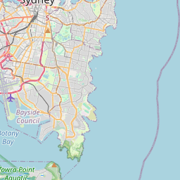
Surry Hills auf der Karte

Datenquellen & Methodik

Unsere Wettervorhersagen werden von einem professionellen Wetterdatenanbieter bereitgestellt, der Daten von nationalen Wetterdiensten, Satellitenbeobachtungen, Radarnetzwerken und über 80.000 Wetterstationen weltweit zusammenführt. Die Vorhersagedaten werden mehrmals täglich aktualisiert. Wir wandeln Rohdaten in übersichtliche Zusammenfassungen um – Windgeschwindigkeit in m/s, Luftdruck in mmHg – damit Sie Ihren Tag mit Zuversicht planen können.