
5-Tage-Wettervorhersage Los Angeles 30. Okt. 2026
 21°
21°Wettervorhersage Los Angeles Freitag 30. Okt. 2026: stellenweise regen möglich, Temperatur von 17 °C bis 21 °C.
Niederschlagswahrscheinlichkeit 24%. Wind bis zu 4.31 m/s (Böen 8.31 m/s). Luftfeuchtigkeit 43–77%, Luftdruck 759–761 mm Hg, UV-Index bis 6.
5 Tage im Überblick — tippen Sie auf einen Tag, um ihn zu öffnen
Sonnenaufgang 07:10
Sonnenuntergang 18:02
Sonnenuntergang 18:02
Abnehmender Mond71% beleuchtet
Mondaufgang 21:43 · Monduntergang 11:59
Mondaufgang 21:43 · Monduntergang 11:59
Diagramm
Tabelle
Fr., 30. Okt. 2026
| Uhrzeit | Wetter | Temperatur | Regenwahrscheinlichkeit | Bewölkung | Feuchtigkeit | Druck | Wind | UV-Index |
|---|---|---|---|---|---|---|---|---|
| 00:00 |  Bedeckt | 19 °C | 15% | 100% | 61% | 760 mm Hg | SSO 157° 2.81 (2.89) m/s | 0 |
| 01:00 | Bedeckt | 19 °C | 15% | 100% | 60% | 761 mm Hg | SSO 160° 2.81 (2.89) m/s | 0 |
| 02:00 |  Stellenweise Regen möglich | 18 °C | 24% (0.04 mm/Std.) | 100% | 75% | 760 mm Hg | SSO 157° 1.39 (3.11) m/s | 0 |
| 03:00 | Bedeckt | 18 °C | 15% | 100% | 62% | 761 mm Hg | S 169° 2.89 (3.22) m/s | 0 |
| 04:00 | Bedeckt | 18 °C | 15% | 100% | 62% | 760 mm Hg | S 174° 2.61 (3.19) m/s | 0 |
| 05:00 | Stellenweise Regen möglich | 17 °C | 23% (0.01 mm/Std.) | 100% | 77% | 759 mm Hg | S 169° 0.89 (2.81) m/s | 0 |
| 06:00 | Stellenweise Regen möglich | 18 °C | 15% (0.01 mm/Std.) | 100% | 60% | 761 mm Hg | S 187° 2 (2.69) m/s | 0 |
| 07:00 | Stellenweise Regen möglich | 18 °C | 15% (0.01 mm/Std.) | 100% | 60% | 761 mm Hg | S 186° 1.69 (2.31) m/s | 0 |
| 08:00 | Stellenweise Regen möglich | 17 °C | 22% (0.02 mm/Std.) | 96% | 76% | 760 mm Hg | S 171° 0.81 (2.5) m/s | 4 |
| 09:00 | Stellenweise Regen möglich | 19 °C | 13% (0.01 mm/Std.) | 93% | 57% | 761 mm Hg | S 180° 1.61 (2.39) m/s | 4 |
| 10:00 | Stellenweise Regen möglich | 19 °C | 12% (0.01 mm/Std.) | 93% | 55% | 761 mm Hg | S 176° 2.19 (2.83) m/s | 4 |
| 11:00 | Stellenweise Regen möglich | 20 °C | 23% (0.15 mm/Std.) | 88% | 64% | 761 mm Hg | S 169° 1.61 (2.92) m/s | 4 |
| 12:00 |  Bewölkt | 20 °C | 9% | 82% | 49% | 761 mm Hg | SSW 193° 2.81 (3) m/s | 4 |
| 13:00 |  Teilweise bewölkt | 20 °C | 3% | 28% | 47% | 761 mm Hg | SSW 199° 3.11 (8.11) m/s | 6 |
| 14:00 | Stellenweise Regen möglich | 21 °C | 13% (0.04 mm/Std.) | 77% | 57% | 759 mm Hg | SSW 212° 2.5 (2.81) m/s | 5 |
| 15:00 | Bewölkt | 21 °C | 9% | 87% | 43% | 760 mm Hg | SSW 204° 3.39 (7.39) m/s | 5 |
| 16:00 | Bewölkt | 21 °C | 7% | 77% | 44% | 760 mm Hg | SSW 202° 4.31 (8.31) m/s | 5 |
| 17:00 | Stellenweise Regen möglich | 20 °C | 11% (0.01 mm/Std.) | 84% | 57% | 759 mm Hg | SSW 206° 2.69 (2.89) m/s | 5 |
| 18:00 | Stellenweise Regen möglich | 20 °C | 12% | 84% | 59% | 759 mm Hg | SSW 203° 2.11 (2.5) m/s | 4 |
| 19:00 | Stellenweise Regen möglich | 19 °C | 12% | 85% | 61% | 759 mm Hg | SSW 200° 1.61 (2) m/s | 0 |
| 20:00 | Stellenweise Regen möglich | 19 °C | 16% (0.04 mm/Std.) | 85% | 63% | 760 mm Hg | SSW 196° 1 (1.61) m/s | 0 |
| 21:00 | Stellenweise Regen möglich | 19 °C | 13% | 82% | 66% | 760 mm Hg | S 191° 0.81 (1.5) m/s | 0 |
| 22:00 | Stellenweise Regen möglich | 18 °C | 13% | 78% | 68% | 760 mm Hg | S 186° 0.5 (1.5) m/s | 0 |
| 23:00 | Stellenweise Regen möglich | 18 °C | 14% (0.01 mm/Std.) | 75% | 70% | 760 mm Hg | S 181° 0.31 (1.39) m/s | 0 |
Fr., 30. Okt. 2026
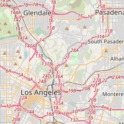
Los Angeles auf der Karte
Datenquellen & Methodik
Unsere Wettervorhersagen werden von einem professionellen Wetterdatenanbieter bereitgestellt, der Daten von nationalen Wetterdiensten, Satellitenbeobachtungen, Radarnetzwerken und über 80.000 Wetterstationen weltweit zusammenführt. Die Vorhersagedaten werden mehrmals täglich aktualisiert. Wir wandeln Rohdaten in übersichtliche Zusammenfassungen um – Windgeschwindigkeit in m/s, Luftdruck in mmHg – damit Sie Ihren Tag mit Zuversicht planen können.