
5-Tage-Wettervorhersage Limbach-Oberfrohna 18-08-2026
Wettervorhersage Limbach-Oberfrohna morgen 18.08.2026: schneesturm, Temperatur von -2 °C bis -1 °C.
Niederschlagswahrscheinlichkeit 69%. Wind bis zu 16.31 m/s (Böen 23.42 m/s). Luftfeuchtigkeit 71–92%, Luftdruck 743–746 mm Hg, UV-Index bis 3.2.
Wetterwarnungen
Warnungen ausblendenModerate Fire Impact
Risk of fires due to prolonged drought. Possible occurrence of severe fire with subsequent damage. Possible damage to ecosystems, property, forestry, agriculture, etc. Risk of human injury. Deterioration of air quality causing respiratory problems and other health issues.
Do not light fires outdoors, do not burn grass, do not smoke or discard cigarette butts on the ground. Do not use portable stoves or other open flame sources. Follow local bans issued due to drought and fire risk. Stay alert when using agricultural machinery and near railway tracks where sparks from wheels and brakes can ignite vegetation.
Moderate Fire Impact
Risk of fires due to prolonged drought. Possible occurrence of severe fire with subsequent damage. Possible damage to ecosystems, property, forestry, agriculture, etc. Risk of human injury. Deterioration of air quality causing respiratory problems and other health issues.
Do not light fires outdoors, do not burn grass, do not smoke or discard cigarette butts on the ground. Do not use portable stoves or other open flame sources. Follow local bans issued due to drought and fire risk. Stay alert when using agricultural machinery and near railway tracks where sparks from wheels and brakes can ignite vegetation.
Moderate Fire Impact
Risk of fires due to prolonged drought. Possible occurrence of severe fire with subsequent damage. Possible damage to ecosystems, property, forestry, agriculture, etc. Risk of human injury. Deterioration of air quality causing respiratory problems and other health issues.
Do not light fires outdoors, do not burn grass, do not smoke or discard cigarette butts on the ground. Do not use portable stoves or other open flame sources. Follow local bans issued due to drought and fire risk. Stay alert when using agricultural machinery and near railway tracks where sparks from wheels and brakes can ignite vegetation.
Moderate Thunderstorm Impact
Risk of severe thunderstorms. Possible local property damage and complications, especially in the energy industry and transport. Potential for local flooding, especially of low-lying areas. Local wind damage to roofs, fences, soft shelters and trees. Local power outages. Some travel delays. Driving conditions difficult. Possible crop damage from small hail. Risk of fire caused by lightning strike. Risk of injury from flying or falling objects, and lightning strikes.
Beware of lightning strikes and flying or falling objects (especially branches). Seek shelter in a building equipped with lightning protection. Outdoors, take cover in dense forest or low vegetation; avoid water bodies, hilltops, metal structures, isolated trees, and rock overhangs. When driving reduce speed. Observe weather warnings, weather radar (www.chmi.cz or mobile apps) and local flood risk https://produkty.chmi.cz/ffi.
Moderate Thunderstorm Impact
Risk of severe thunderstorms. Possible local property damage and complications, especially in the energy industry and transport. Potential for local flooding, especially of low-lying areas. Local wind damage to roofs, fences, soft shelters and trees. Local power outages. Some travel delays. Driving conditions difficult. Possible crop damage from small hail. Risk of fire caused by lightning strike. Risk of injury from flying or falling objects, and lightning strikes.
Beware of lightning strikes and flying or falling objects (especially branches). Seek shelter in a building equipped with lightning protection. Outdoors, take cover in dense forest or low vegetation; avoid water bodies, hilltops, metal structures, isolated trees, and rock overhangs. When driving reduce speed. Observe weather warnings, weather radar (www.chmi.cz or mobile apps) and local flood risk https://produkty.chmi.cz/ffi.
5 Tage im Überblick — tippen Sie auf einen Tag, um ihn zu öffnen
Sonnenaufgang 06:01
Sonnenuntergang 20:24
Erstes Viertel37% beleuchtet
Mondaufgang 13:24 · Monduntergang 22:06
Diagramm
Tabelle
| Temperatur | Regenwahrscheinlichkeit | Bewölkung | Feuchtigkeit | Druck | Wind | UV-Index | ||
|---|---|---|---|---|---|---|---|---|
| 00:00 | Schneesturm | -2 °C | 36% (0.1 mm/Std.) | 100% | 72% | 743 mm Hg | W 274° 14.39 (19.22) m/s | 0 |
| 01:00 | Schneesturm | -2 °C | 35% (0.09 mm/Std.) | 100% | 71% | 743 mm Hg | W 277° 14.69 (19.5) m/s | 0 |
| 02:00 | Schneesturm | -2 °C | 37% (0.09 mm/Std.) | 100% | 73% | 743 mm Hg | W 277° 15.31 (20.31) m/s | 0 |
| 03:00 | Schneesturm | -2 °C | 36% (0.09 mm/Std.) | 100% | 73% | 744 mm Hg | W 277° 15.81 (20.92) m/s | 0 |
| 04:00 | Schneesturm | -2 °C | 37% (0.1 mm/Std.) | 100% | 74% | 744 mm Hg | W 277° 15.69 (21.14) m/s | 0 |
| 05:00 | Schneesturm | -2 °C | 37% (0.09 mm/Std.) | 100% | 74% | 744 mm Hg | W 278° 16.31 (22.11) m/s | 0 |
| 06:00 | Schneesturm | -2 °C | 29% (0.09 mm/Std.) | 64% | 75% | 744 mm Hg | W 277° 16.11 (22.31) m/s | 0 |
| 07:00 | Schneeverwehungen | -2 °C | 27% (0.07 mm/Std.) | 77% | 75% | 744 mm Hg | W 278° 15.81 (22.31) m/s | 0.1 |
| 08:00 | Schneesturm | -2 °C | 29% (0.08 mm/Std.) | 62% | 76% | 744 mm Hg | W 277° 16 (22.64) m/s | 0.3 |
| 09:00 | Schneeverwehungen | -2 °C | 29% (0.07 mm/Std.) | 81% | 76% | 745 mm Hg | W 277° 15.81 (22.11) m/s | 1.2 |
| 10:00 | Stellenweise Schnee möglich | -2 °C | 23% (0.06 mm/Std.) | 79% | 75% | 745 mm Hg | W 279° 15.39 (23.42) m/s | 2.6 |
| 11:00 | Schneesturm | -2 °C | 46% (0.14 mm/Std.) | 100% | 83% | 745 mm Hg | WNW 284° 14.5 (19.61) m/s | 3.2 |
| 12:00 | Schneesturm | -1 °C | 58% (0.38 mm/Std.) | 100% | 80% | 745 mm Hg | WNW 290° 15.89 (23.03) m/s | 2.8 |
| 13:00 | Schneesturm | -2 °C | 69% (0.49 mm/Std.) | 91% | 92% | 745 mm Hg | W 265° 14.31 (17.86) m/s | 3.1 |
| 14:00 | Stellenweise Schnee möglich | -1 °C | 28% (0.23 mm/Std.) | 70% | 72% | 745 mm Hg | W 270° 15.19 (19.92) m/s | 1.9 |
| 15:00 | Schneeverwehungen | -1 °C | 23% (0.01 mm/Std.) | 90% | 71% | 745 mm Hg | W 273° 15.11 (20.11) m/s | 2.6 |
| 16:00 | Schneeverwehungen | -1 °C | 26% (0.02 mm/Std.) | 100% | 72% | 746 mm Hg | W 274° 14.31 (19.72) m/s | 0.4 |
| 17:00 | Schneeverwehungen | -1 °C | 27% (0.02 mm/Std.) | 100% | 73% | 746 mm Hg | W 276° 13 (18.72) m/s | 0.2 |
| 18:00 | Schneeverwehungen | -1 °C | 28% (0.03 mm/Std.) | 100% | 74% | 746 mm Hg | W 279° 12.11 (17.72) m/s | 0.1 |
| 19:00 | Schneeverwehungen | -1 °C | 30% (0.02 mm/Std.) | 100% | 78% | 746 mm Hg | W 280° 10.81 (15.53) m/s | 0 |
| 20:00 | Schneesturm | -2 °C | 49% (0.16 mm/Std.) | 100% | 85% | 745 mm Hg | W 279° 9.89 (12.92) m/s | 0 |
| 21:00 | Schneesturm | -2 °C | 56% (0.22 mm/Std.) | 100% | 91% | 745 mm Hg | W 273° 8.19 (10.61) m/s | 0 |
| 22:00 | Mäßige bis starke Schneeschauer | -2 °C | 42% (0.11 mm/Std.) | 100% | 90% | 744 mm Hg | W 264° 6.69 (8.81) m/s | 0 |
| 23:00 | Mäßige bis starke Schneeschauer | -2 °C | 36% (0.14 mm/Std.) | 100% | 78% | 743 mm Hg | WSW 252° 5.61 (7.81) m/s | 0 |
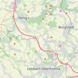
Limbach-Oberfrohna auf der Karte
Datenquellen & Methodik
Unsere Wettervorhersagen werden von einem professionellen Wetterdatenanbieter bereitgestellt, der Daten von nationalen Wetterdiensten, Satellitenbeobachtungen, Radarnetzwerken und über 80.000 Wetterstationen weltweit zusammenführt. Die Vorhersagedaten werden mehrmals täglich aktualisiert. Wir wandeln Rohdaten in übersichtliche Zusammenfassungen um – Windgeschwindigkeit in m/s, Luftdruck in mmHg – damit Sie Ihren Tag mit Zuversicht planen können.